As promised, I’m following my plan of working during the week and doing national park visits on weekends. This last week was pretty intensely busy, and next week looks the same, but I took time out yesterday to visit what is probably one of the lesser-known national parks, Black Canyon of the Gunnison.
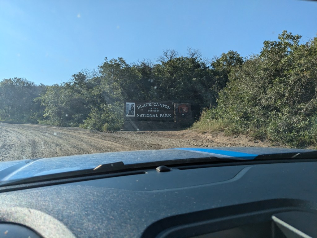
My first challenge was getting there. When I planned this trip last winter/ spring, it seemed straightforward; the park is only about an hour’s drive from Thousand Trails Blue Mesa near Gunnison, Colorado, where I can camp for free with my membership. The two are connected by US-50, the major highway through this region. US-50 runs along the north side of Blue Mesa Reservoir and provides access to Thousand Trails, then crosses over the reservoir on a short bridge (less than a quarter mile long I think) and continues westward along the south side of the reservoir. There are no other paved roads in the area making that same connection.
Perhaps you can see where this is going. Sometime last spring, an inspector looked at the bridge across the reservoir and immediately called in to headquarters with some official version of “Oh, crap.” The bridge was unsafe. It had deteriorated to the point that it was in danger of collapse and had to be shut down immediately. This was very, very bad news for thousands of residents and tourists who depend on that bridge to get from east to west and back. The paved detour to get around that quarter-mile of closed road is about 6 hours of extra driving. Colorado powers-that-be came up with another alternate, but it involved about an extra hour of drive time and a 15-mile drive on a single-track “natural surface and gravel” road that involved sending cars one direction at a time with a pilot car once every hour and a half. Not ideal.
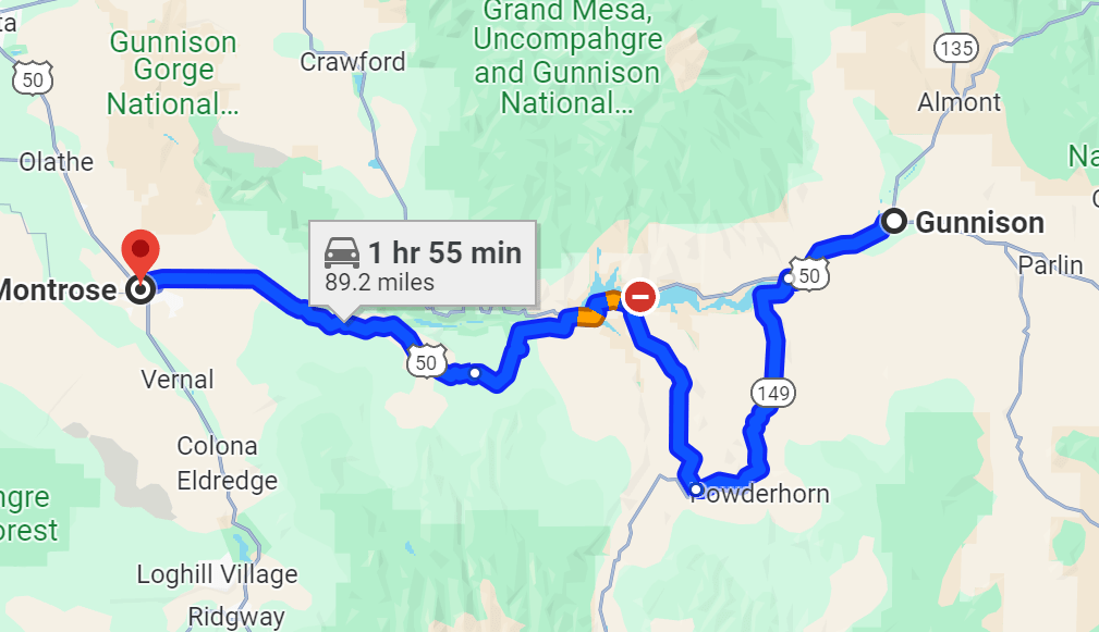

Just earlier this month, they got the bridge re-opened… sort of. Only one lane of it can be used, so again, it involves a pilot car leading traffic back and forth in alternate directions (but with a much shorter period). This is only open from 6:30-8:30 am and 4:30-6:30pm each day, presumably so they can continue with repairs the rest of the day. Also, only passenger vehicles are allowed to cross; RVs and big trucks are still banned. If you stop and think about it, that’s not a great vote of confidence from the engineers.
Nevertheless, I opted to get up early on Saturday and take my chances with the bridge route to save myself an hour of extra driving on a bumpy road. On my westbound trip, this worked very well. My wait at the bridge was short, and my overall trip didn’t take much more than the advertised hour.
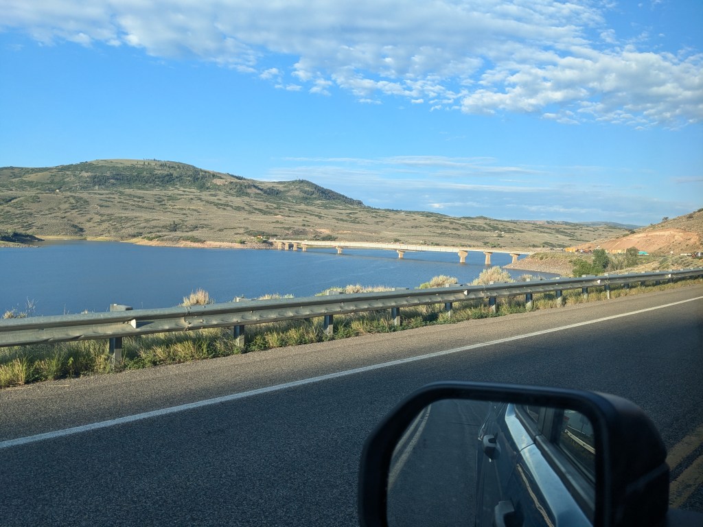
I got to see a lot of countryside between the reservoir and the park. This land is hard to classify. The area around my campground is mostly what I would call “sagebrush desert,” with high bare hills covered with short drought-hardy grasses and shrubs. But it also has groves of trees — fir, aspen, and cottonwood– in the crevices of the land where water collects. To give you an idea, these two pictures were taken close together, just pointed in different directions.

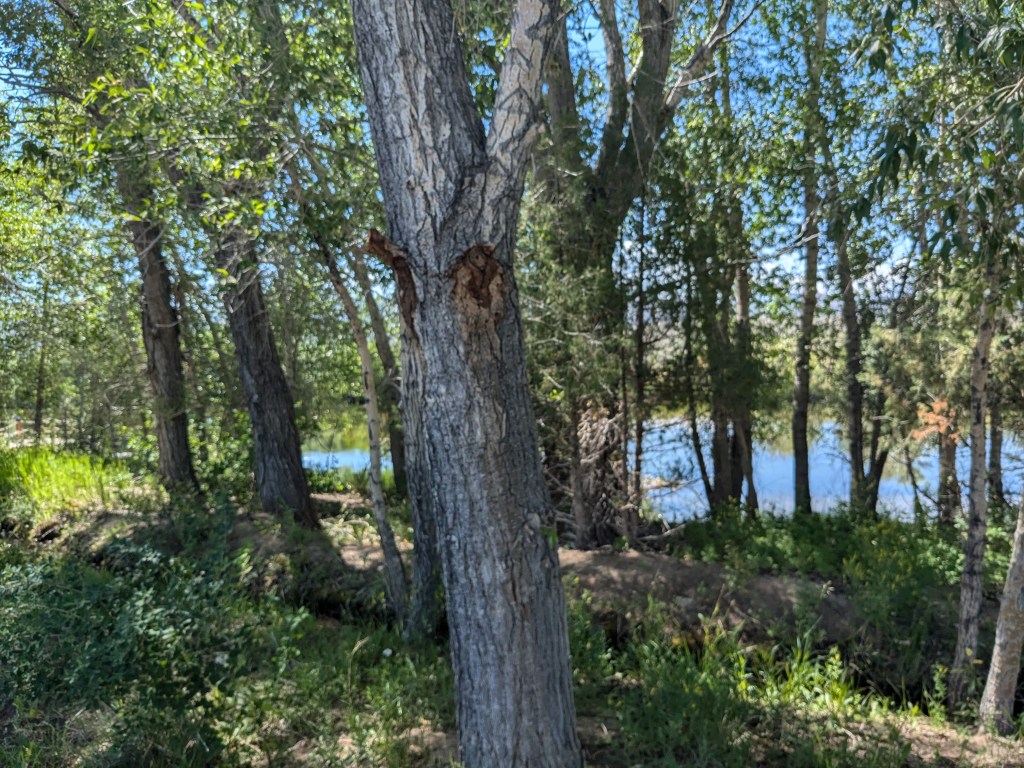
On my way to Black Canyon, I passed through more areas like that, but also some hills that were thickly covered with fir woods as in Rocky Mountain National Park. Basically, if you don’t like the scenery, drive a couple of miles and it will change. I suppose little shifts in sunlight, slope, soil, snow, and rain showers make all the difference.
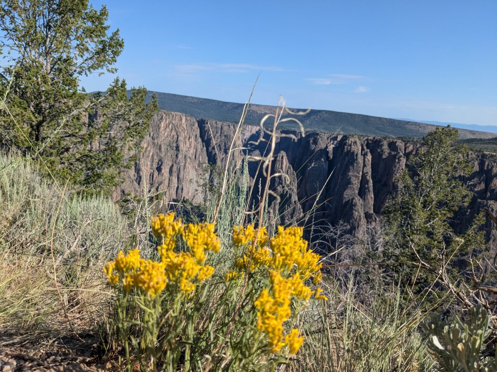
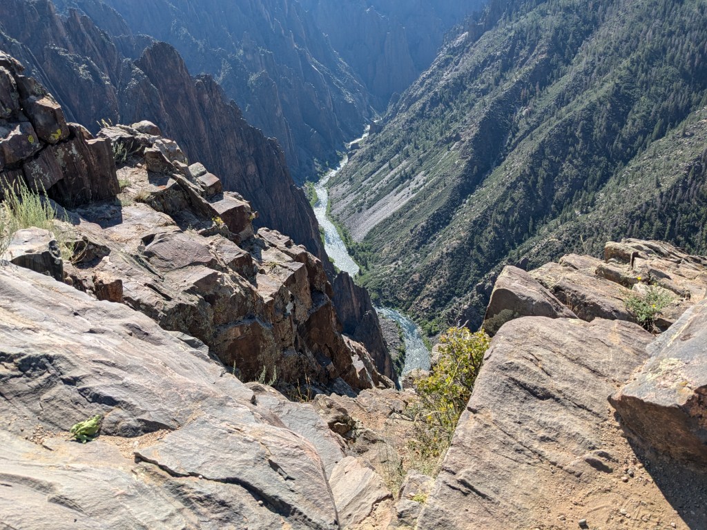
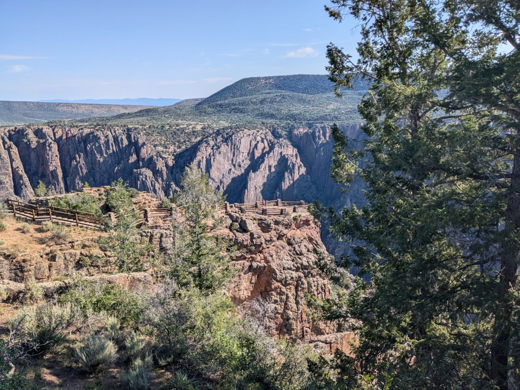
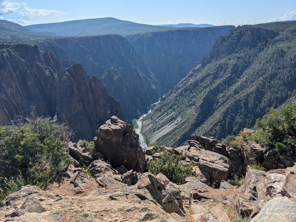
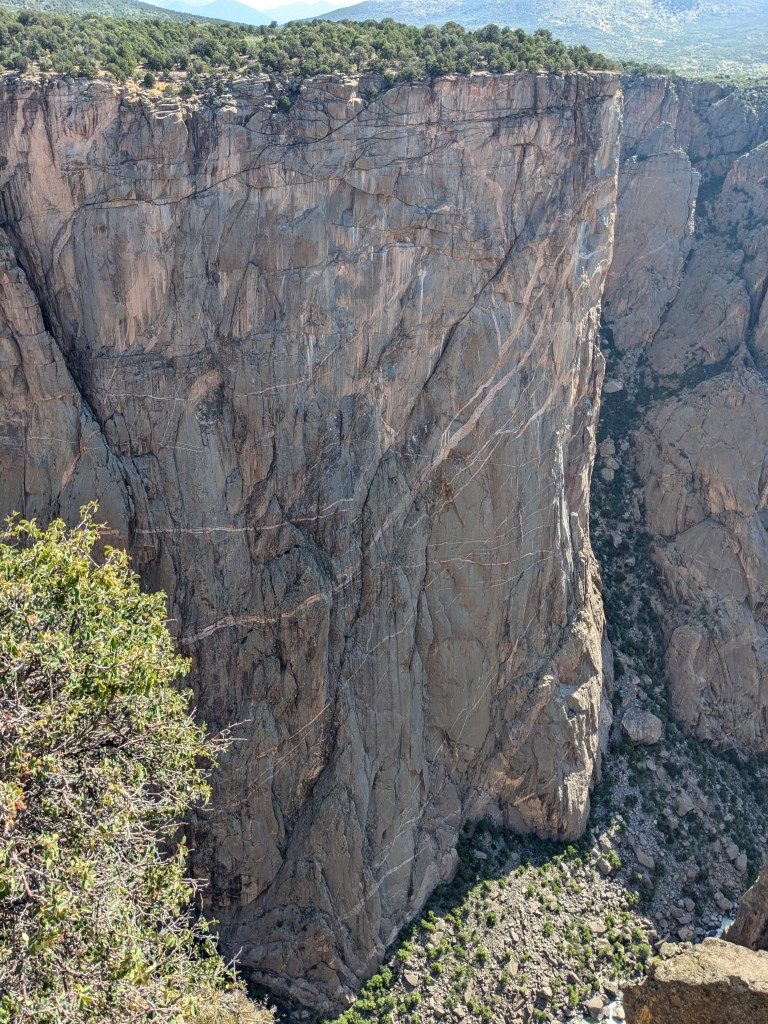
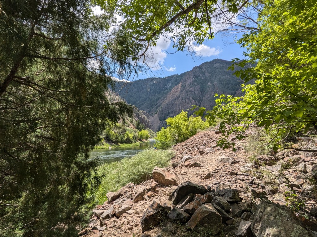
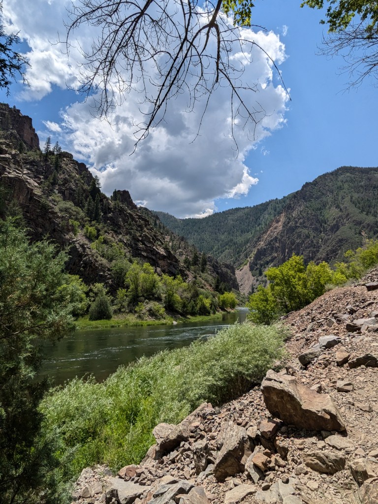
Black Canyon is much the same, with incredible contrasts along its rim and floor. The canyon is carved by the Gunnison River, the same river that was dammed to make Blue Mesa Reservoir; it flows swiftly along the canyon floor. And it flows WEST. I can’t fully explain to y’all how much that weirds me out… not just about this river, but every stream and rivulet that I encounter on this side of the Continental Divide. I’m a Southeast Texas girl and I am deeply conditioned to expect all water to flow roughly northwest to southeast, toward the Gulf. Here, of course, it is all flowing west to the Pacific Ocean. I have a reasonably good sense of direction, so when I encounter water running west, it feels almost as wrong as if I came across water running uphill. When I first looked down into the canyon and saw the river flowing west through it, it gave me a jolt.
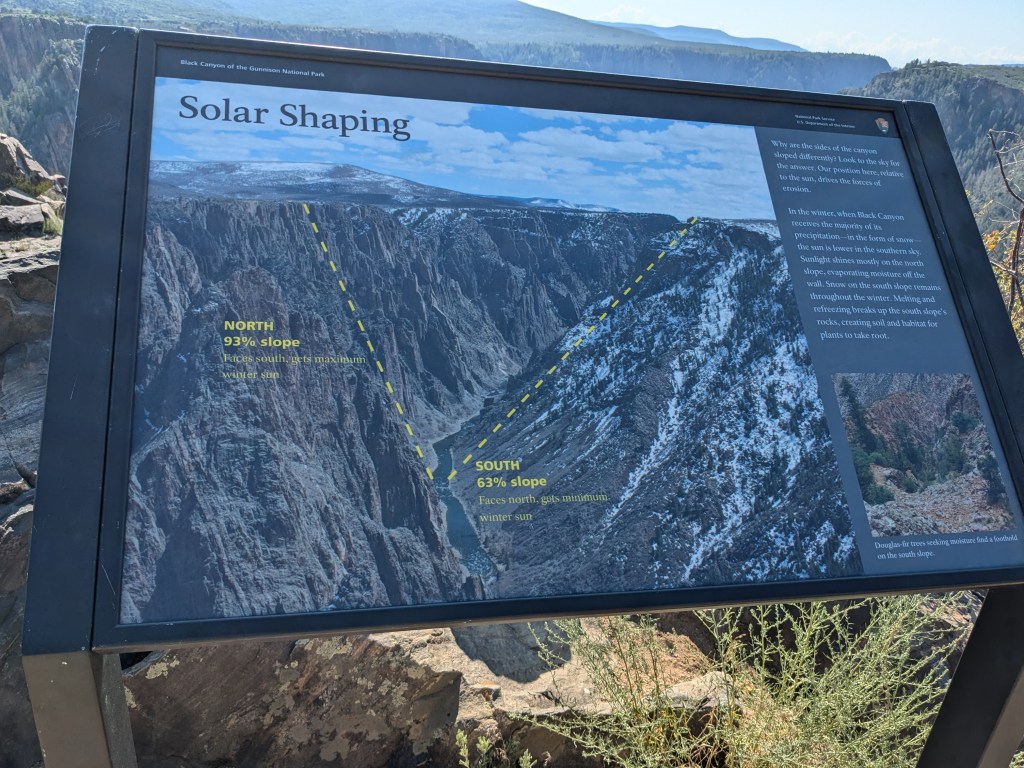
I think anyone who has been to the Grand Canyon (I mean THE Grand Canyon, the one in Arizona on the Colorado River) tends to automatically compare every other canyon to it… at least, that’s where my head goes. Black Canyon is obviously not as wide, deep, or long as the Grand Canyon. According to one of the Visitors’ Center exhibits, it is actually pretty comparable to the Grand Canyon of Yellowstone, which I got to see a couple of years ago. It has some of the same drama as the big Grand Canyon with its vast rocky outcroppings and sheer cliffs, but it’s all on a more “human” scale. You can clearly see and hear the river from the rim. I’m glad that the bridge situation made me get there early in the morning, because it was particularly beautiful in the morning light.
As with the Grand Canyon, Black Canyon has most of its development and tourism on the South Rim, with more “primitive” camping/ visiting opportunities on the North Rim (which is also a LONG drive around). I opted to stick with the (mostly) paved road on the South Rim with its more developed Visitors’ Center and overlooks. In contrast to the Grand Canyon, though, you can also reach the canyon floor by road through the East Portal road, which descends to the level of the floor at the eastern edge of the park. I was excited about being able to do that. One of the drawbacks to the Grand Canyon is that there is no way to take a car down there, so you either have to be very fit (hiking or riding a mule down… and back up) or rich enough to pay for a helicopter ride that lands on the canyon floor.
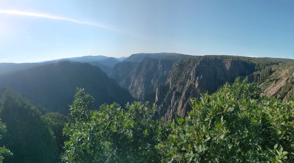
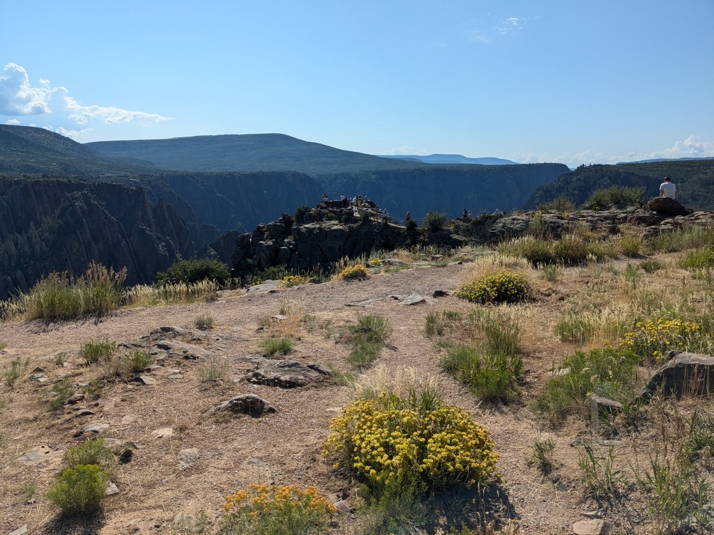
But I did the South Rim first, driving along and stopping at several of the overlooks. I didn’t try any long hikes; walking uphill at altitude still makes me pant, and the High Point overlook at the west end of the park road is 8,287 feet (2,525 meters). But even some of the overlooks involved a few hundred yards of walking.


At Pulpit Rock, I happened to arrive just in time for a park ranger’s presentation on the Civilian Conservation Corps, which constructed much of the park’s initial infrastructure in 1938. The CCC’s fingerprints are all over our national park system, and I have to say that it was one of FDR’s better ideas.

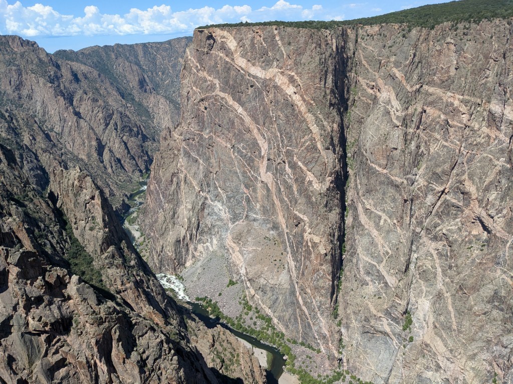
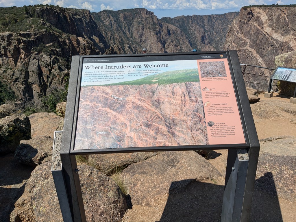
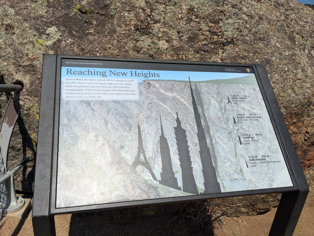
Perhaps the most striking feature of the canyon is the Painted Wall. “Tallest Cliff in Colorado” is quite a claim to fame.

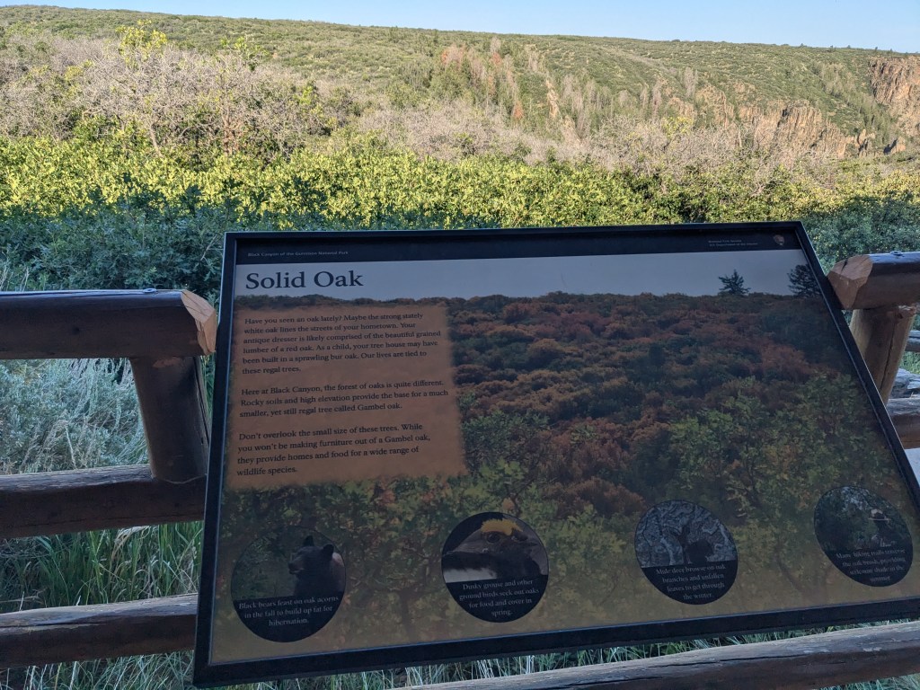
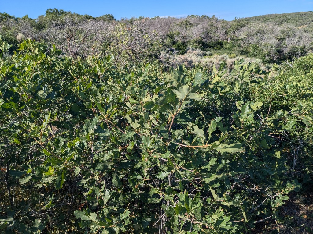
Another thing that fascinated me were the “miniature” trees that are actually ancient, adapted to their harsh environment by staying small and growing slowwwwwly. I’ve encountered this in other places (like the tundra in Alaska) but Black Canyon has some interesting specimens. I’m not sure I had seen Gambel oak before. It’s so odd seeing fully-formed oak leaves on a little bush!
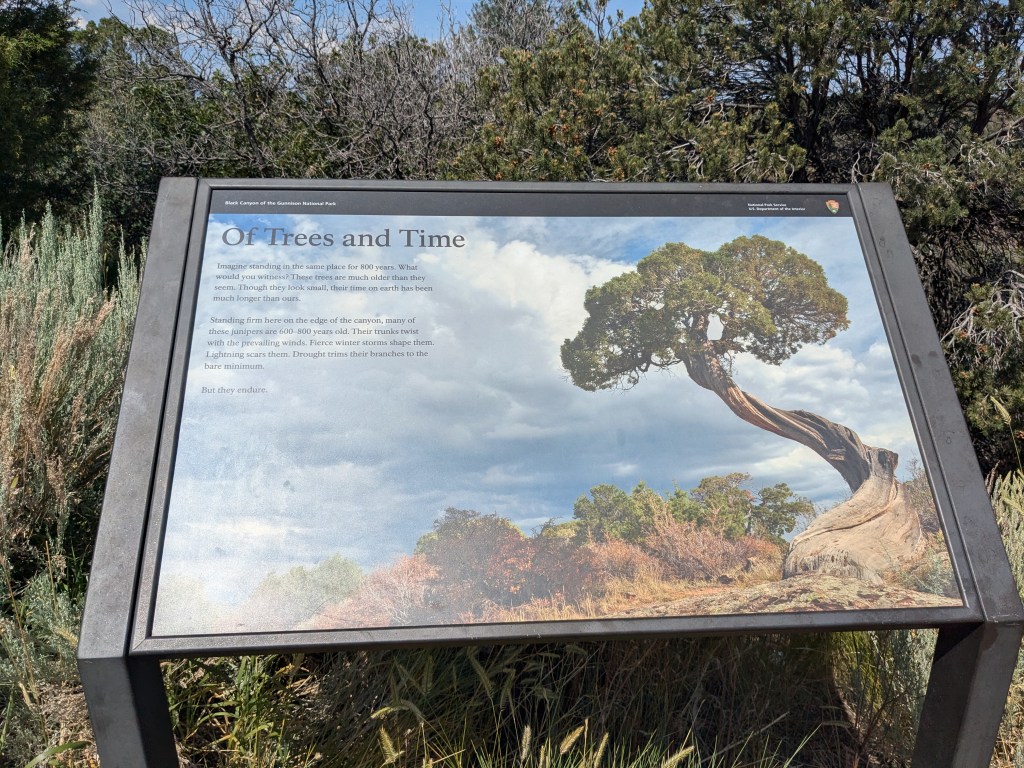
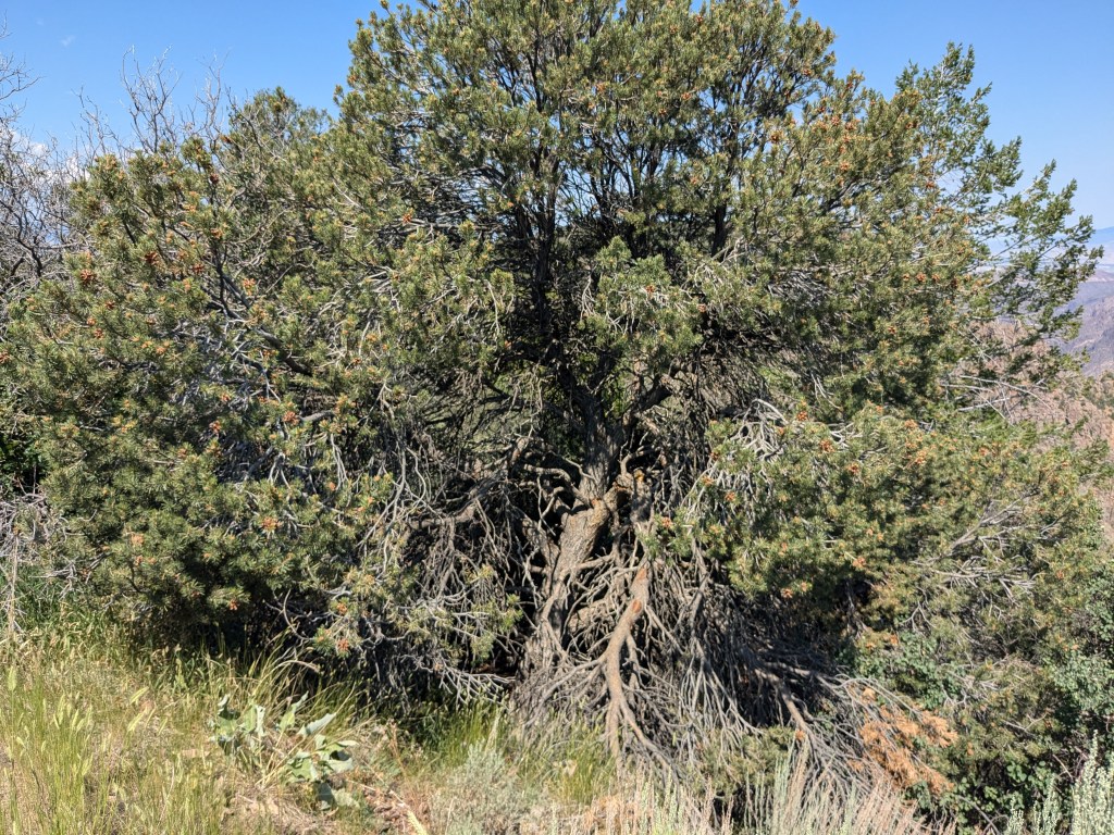
The age of those ordinary-looking little junipers just blows me away. They were growing there when Columbus set sail from Genoa, and maybe when King John signed the Magna Carta.
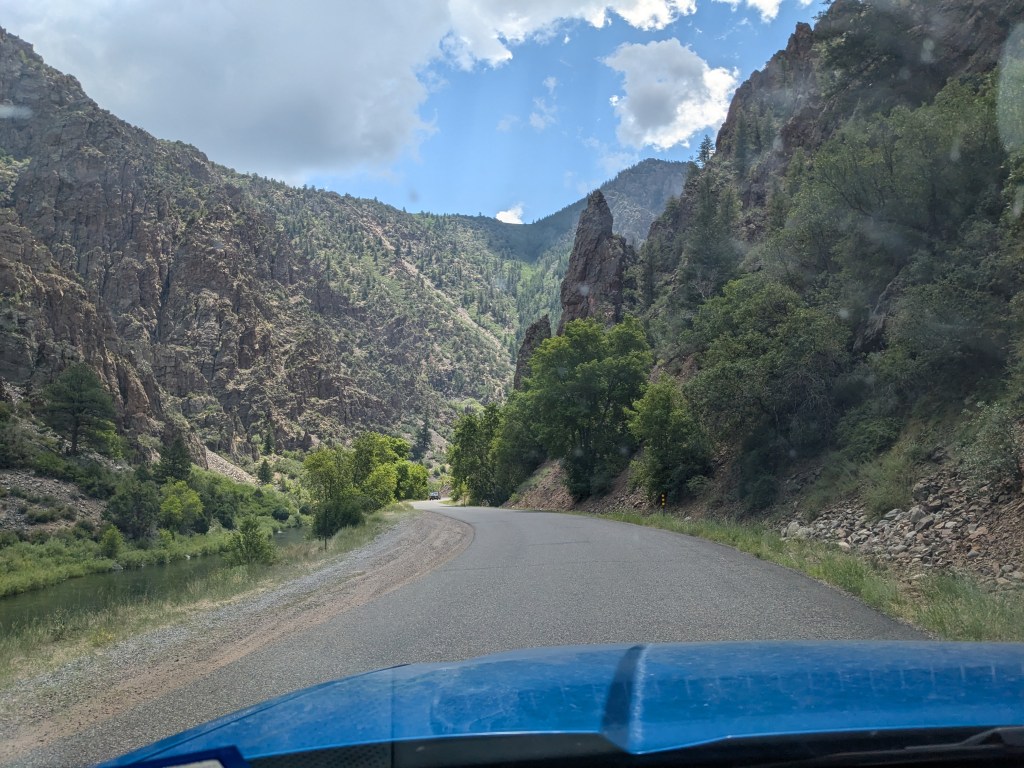
After reaching the end of the park road and coming back, I turned down the East Portal road to see the canyon from below. It’s a steep (16% grade) road with hairpin switchbacks; I was very glad to be in my truck rather than the RV! In fact, RVs longer than 22 feet aren’t even allowed on it. But it was an amazing view all the way down.
The road forks at the bottom. One side runs east, away from the park (but still inside the canyon walls) up to the Crystal River dam, which controls the flow of the Gunnison into the park. (I couldn’t get a very good picture since it was fenced off, but I could see it through the trees.)


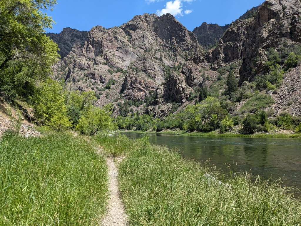
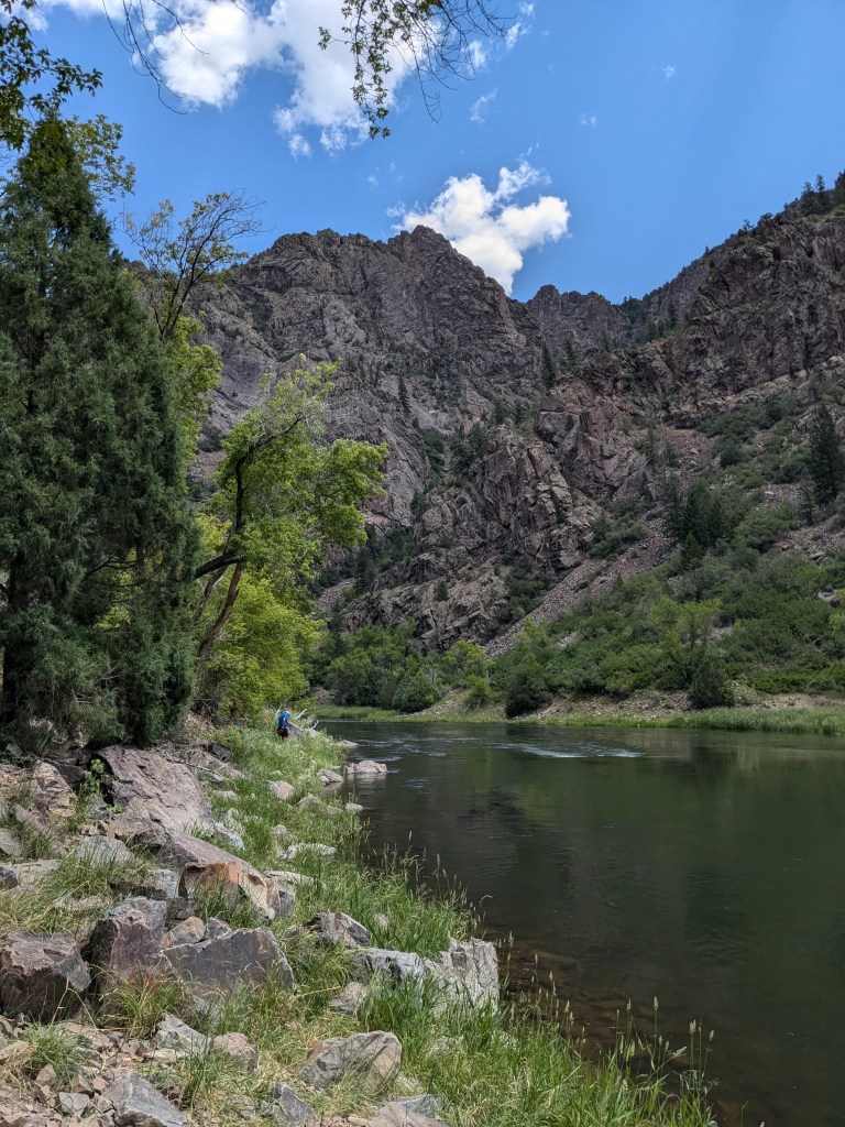
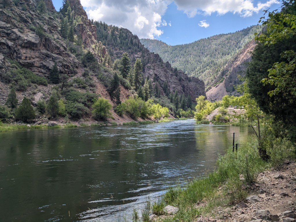
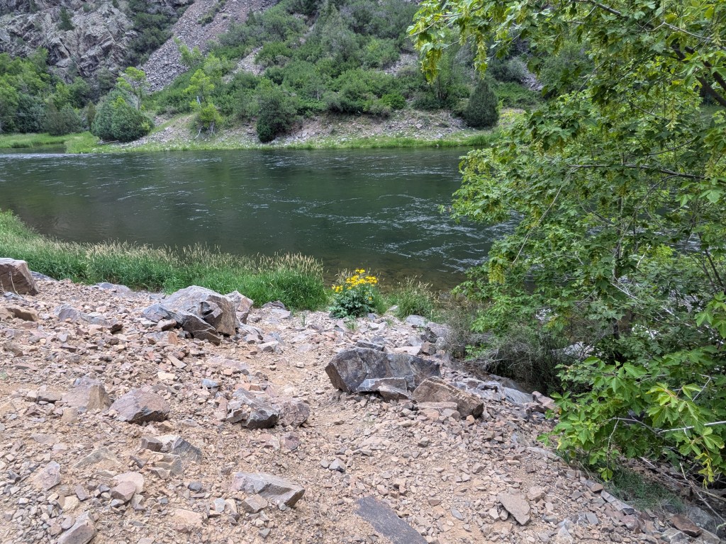
In the other direction, the road runs a short distance west into the far east end of the park. It dead-ends in a primitive campground, with a short footpath running along the riverbank for the convenience of hikers and anglers. I got out and walked this to get my bottom-of-the-canyon shots.
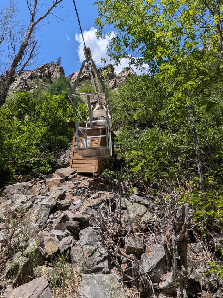
I was interested to see that the U.S. Geological Survey maintains little stations along the river to gauge the level and flow. One of these had a basket on a cable to cross the river.
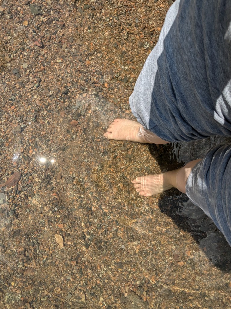
I couldn’t resist the urge to get my feet wet, though the pebbles made me wish I had my Crocs!
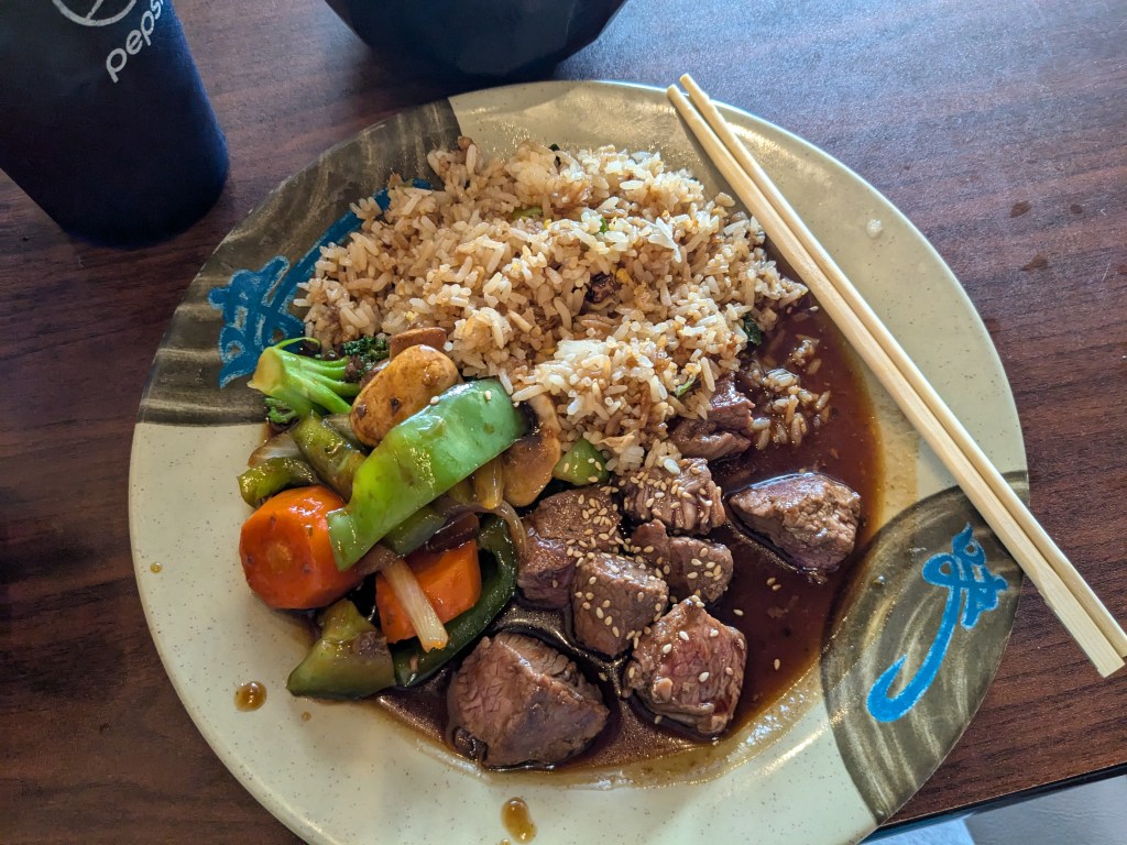
I would have loved to venture deeper into the canyon floor, up underneath the Painted Wall, but that requires a Wilderness Permit and a level of physical fitness/ rock climbing skill that is well beyond me. So I called it a day and instead went into town in Montrose for a great lunch at a Japanese restaurant.
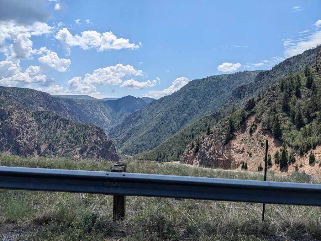
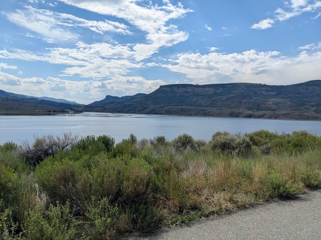
I had to kill some time if I were going to wait for the bridge to reopen at 4:30, so I did some sitting and reading in my truck. Traffic was heavier and the crossing slower on the way back. I probably would have gotten home much sooner if I’d just gritted my teeth and done the dirt road passage. But at least I got a nice view while I waited.
And that was it for this weekend’s adventures. Next weekend should take me east to the Great Sand Dunes, so at least the ailing bridge won’t be an issue!

Leave a comment