My first stop in Utah was my campground, a state park conveniently located at the entrance to Canyonlands National Park. Fortunately, it was a nice park with an electrical hookup for my RV. Unfortunately, the park’s name is Dead Horse Point State Park. Yeah, it’s pretty awful. The park is beautiful and deserves a nicer name for sure. I looked at the interpretive signage for the history of the name, to see if there was a story worth telling, but unfortunately that was pretty awful too. I don’t need to repeat it here.
This part of my trip was moving fast. I toured Mesa Verde on Sunday morning and drove to Utah Sunday afternoon, then went out on Monday to explore Canyonlands National Park.
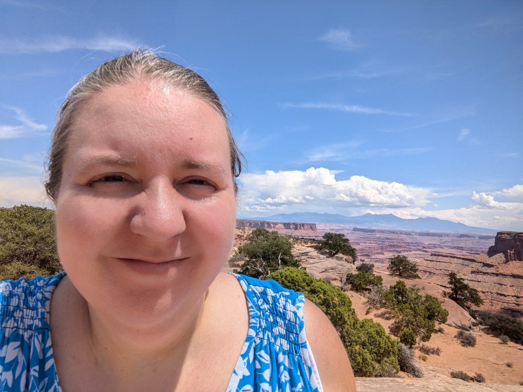
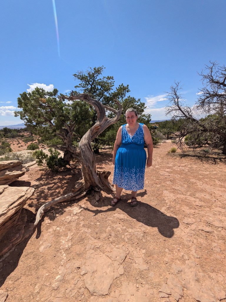
I didn’t make it out there until the middle of the day, and the temperature was well into the 90s (my truck thermometer eventually measured 104F/ 40C). In between the unshaded glaring sun, the heat, and the altitude, I made an executive decision at the start of the day that I was not going to do anything strenuous, meaning NO hiking. I would see what I could see from my truck plus short strolls to overlooks. So committed was I to this plan that I wore a sundress and flipflop sandals. Honestly the sandals probably weren’t the best idea anyway, since even some of the overlooks involved a bit of rock scrambling that would have benefitted from sneakers.

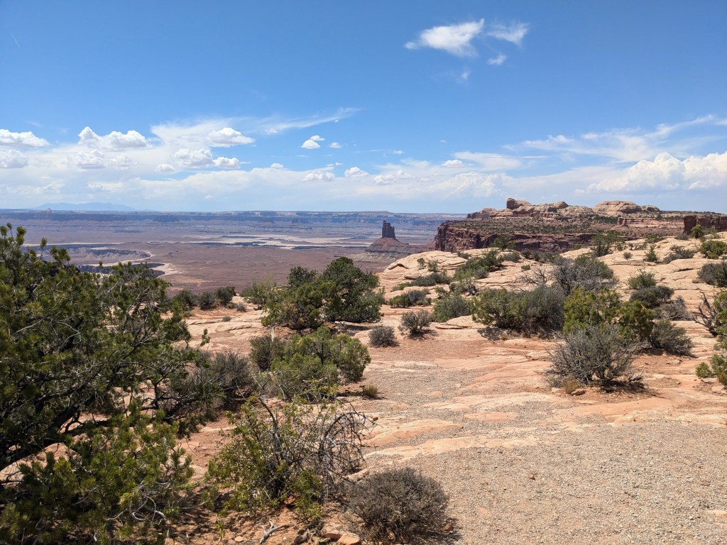
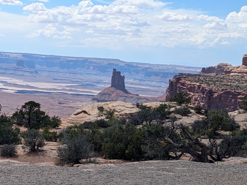
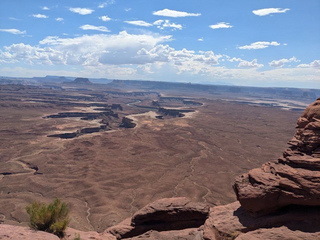
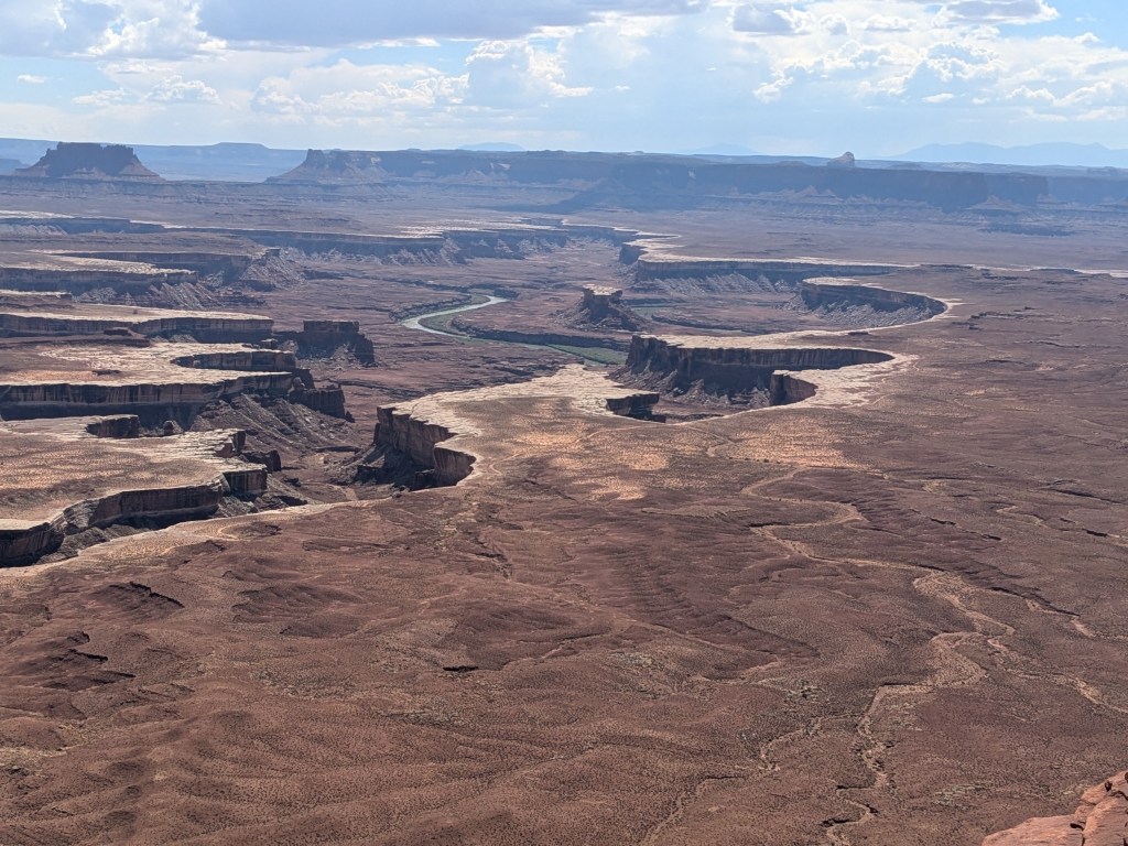
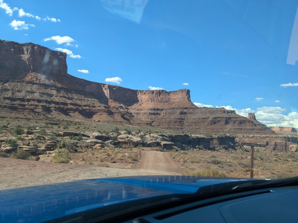
Canyonlands has three distinct districts: Island in the Sky (love that name!), the Needles, and the Maze. I only visited Island in the Sky, the part closest to my campground, because the three districts are not connected internally within the park and it takes a multi-hour drive around the outside to reach one from the other. The internal division is very much a matter of topography. Canyonlands is essentially one huge canyon with smaller canyons in its floor. It is carved by the Green and Colorado rivers. The Colorado River enters from the northeast and exits to the south, while the Green River enters from the northwest and flows into the Colorado in the middle (“The Confluence”), forming a Y shape across the canyon floor. Island in the Sky is the land between the two upper arms of the Y; The Maze is to the lower left; and The Needles is to the lower right. There are no bridges across the rivers within the canyon, so the three districts remain separated for travel purposes even though they are right next to each other.
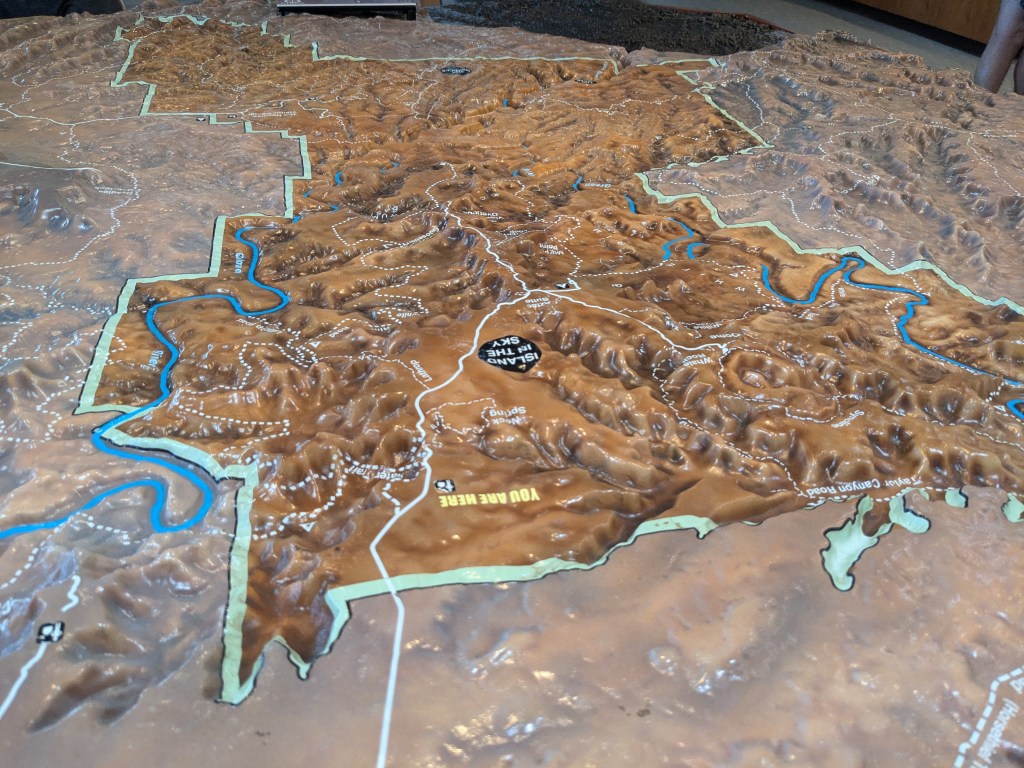
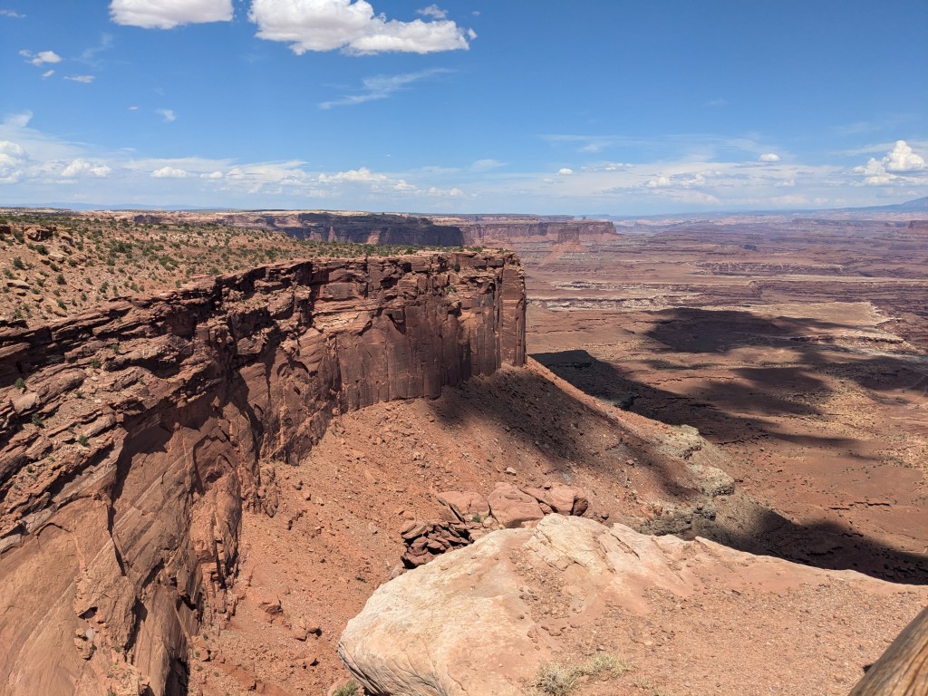
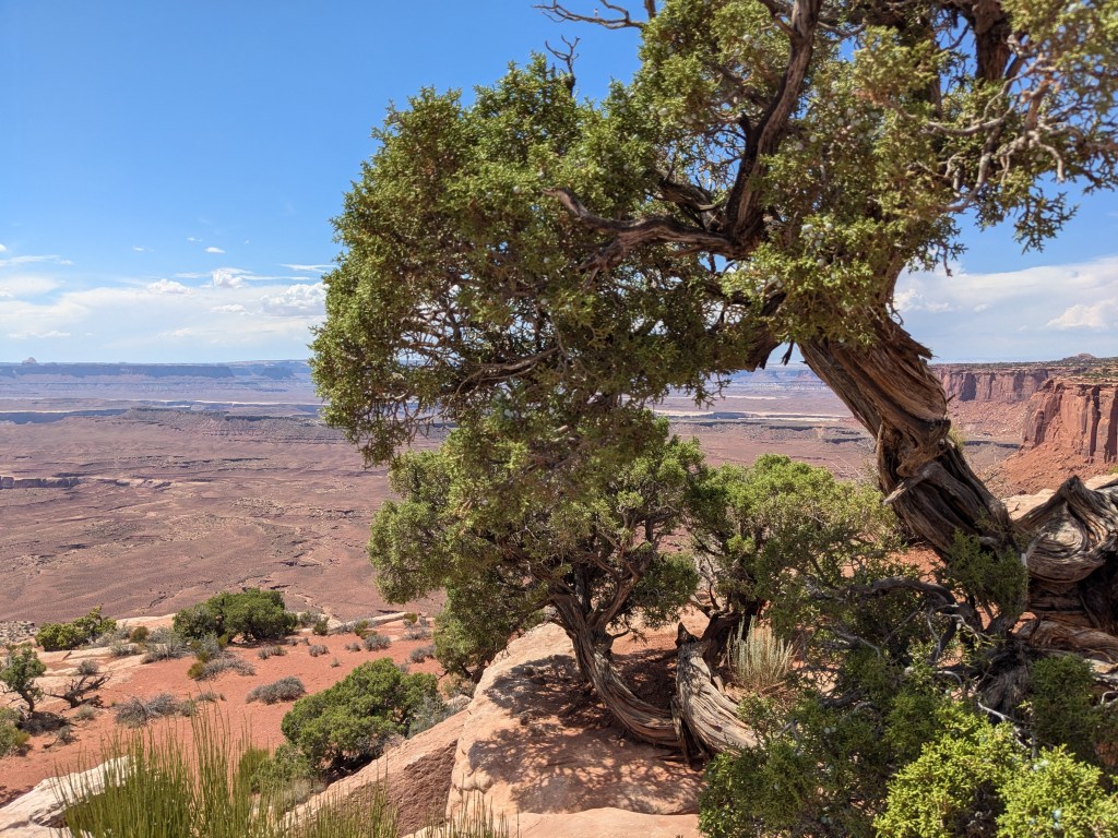
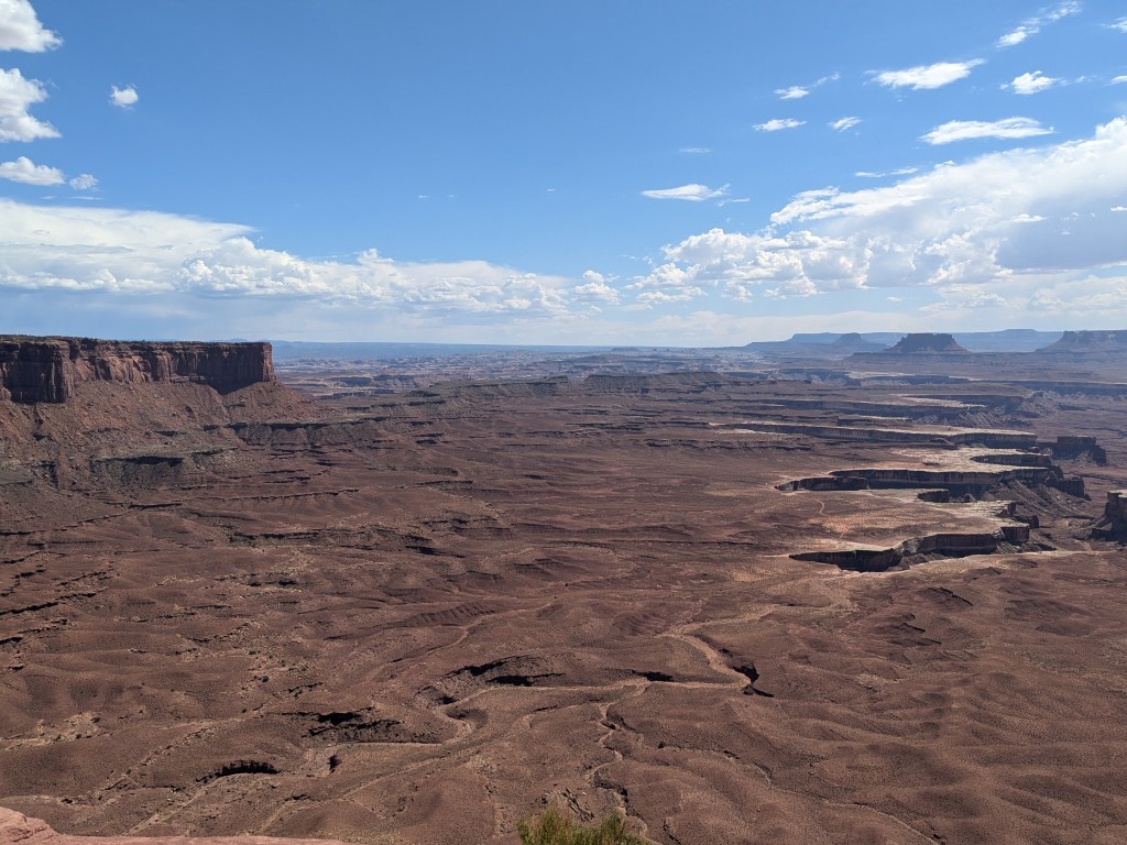
Island in the Sky is essentially a huge mesa (12 miles across) that rises up from the canyon floor just inside the north rim of the canyon. It’s not quite an “island” because it is connected to the canyon rim by a 40-foot-wide strip of land (“The Neck”) across which the park road passes. In the late 1800s, the mesa top offered rich grazing for ranchers, so cowboys drove their cattle across The Neck into its pastures. They could drop fencing across The Neck and the cattle would be effectively contained, since the only other way off the mesa top was jumping over a cliff into the canyon.
Looking back before that, the canyon served for a while as a home to Native Americans, including some of the same tribe of Ancestral Puebloans that lived in Mesa Verde, but they seem to have moved on around the same time that the Mesa Verde Puebloans did (1300). For the next 500 years, there’s evidence that various Native American groups visited and explored the canyon, but there doesn’t seem to have been much settlement there until the ranchers came along. Unfortunately, the ranchers seem to have allowed their cattle to over-graze the mesa top. There’s still grass there, but it’s not nearly as rich and abundant as what the early cowboys described. The land is still in recovery.
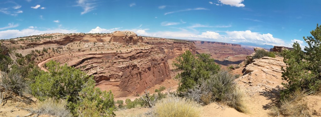
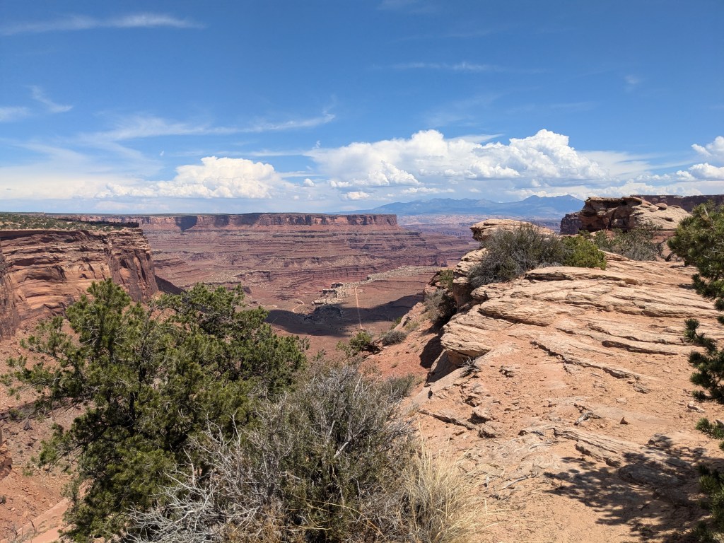
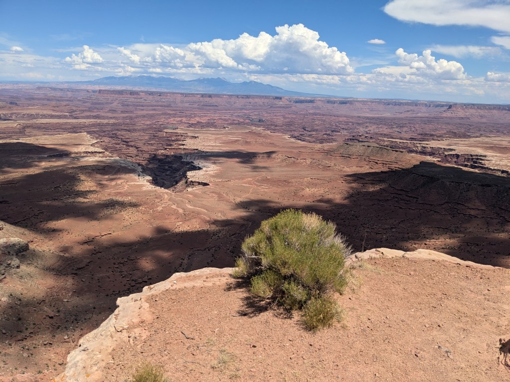
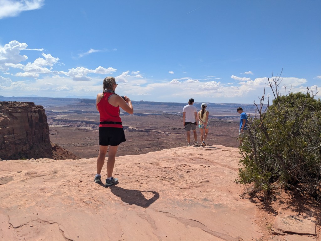
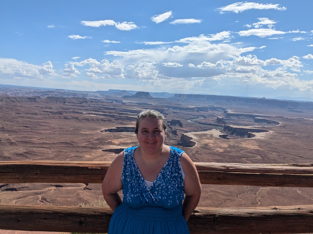
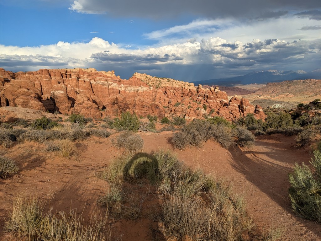
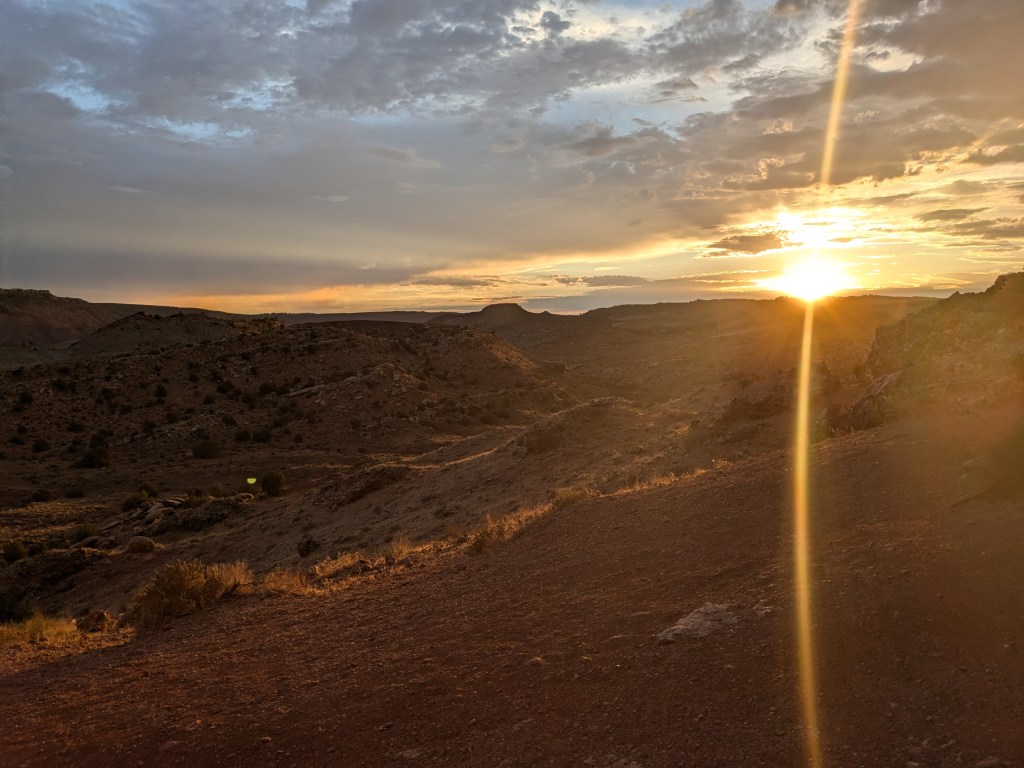
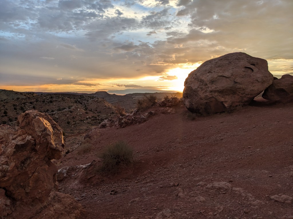
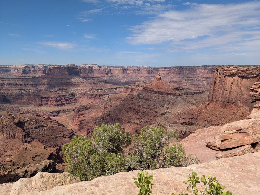
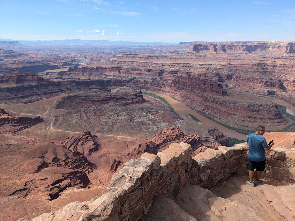
But the views from the top are spectacular. I drove along the park road across the top of the mesa and stopped at overlooks to take pictures. I was also listening to the Guide Along tour (source of much of the information above). In between using the GPS for the tour, the camera’s heavy processor use, and the heat radiating through my windshield, I had some big issues with my poor phone overheating and shutting off. So I probably didn’t get quite as many pictures as I should have, but here’s the best of what I got for your enjoyment.


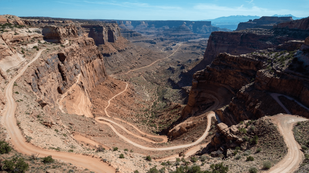
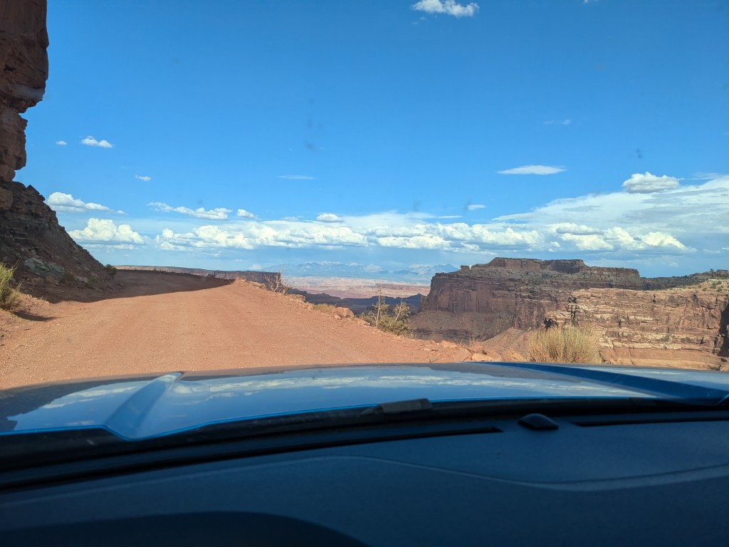
And that more or less concluded my driving tour of Canyonlands, and would have been the end of my report… but I felt like it was a little “flat” (literally and figuratively). I still wasn’t interested in hiking in the brutal heat, but I was “down” for a little adventure on the canyon floor. So I decided to attempt the Shafer Trail.
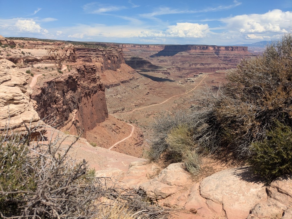
According to Guide Along, the Shafer Trail started life as a deer-and-sheep path down the canyon slope. Then along came a rancher by the name of John Shafer who decided to improve it to take his cattle up and down between their summer grazing on the mesa and winter pasture on the canyon floor. Then in the 1950s, when the US Atomic Commission was frantically stockpiling uranium for weapons and the Uranium Boom took Colorado and Utah by storm, miners widened and improved the trail enough to accommodate motor vehicles… just barely.
The Guide Along guide made a point of telling his listeners NOT to attempt driving the Shafer Trail, and had us pull off at an overlook where we could see it from the top, apparently under the assumption that when we saw it we would say, “Oh, no way!” Only it didn’t have that effect on me.
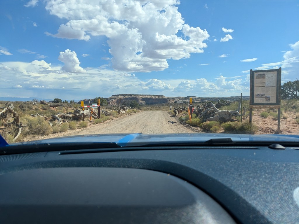
4WD is “highly recommended” for the trail, but I talked to a park ranger at the Visitors’ Center and asked if I’d be ok with 2WD. He asked what I was driving to see if it had enough clearance, and when I told him a Ford Maverick, he said that should be fine, since he had done it himself many times in a 2WD Silverado. That didn’t particularly comfort me since a Silverado is considerably bigger with more clearance than a Maverick. But I decided to go for it.
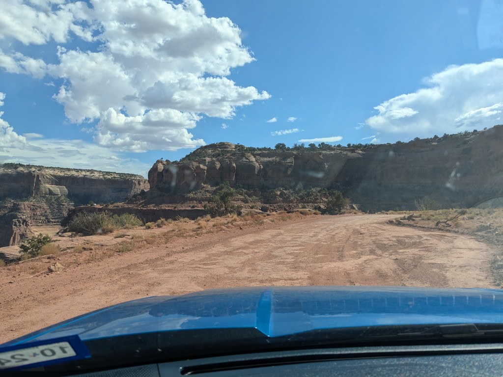
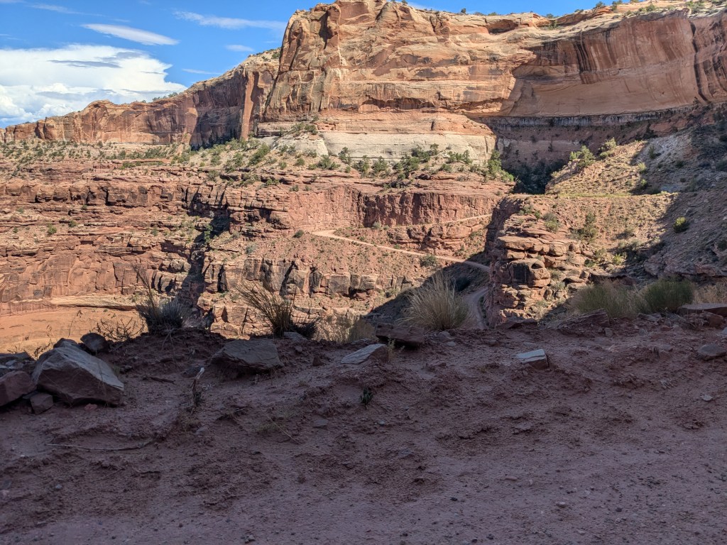
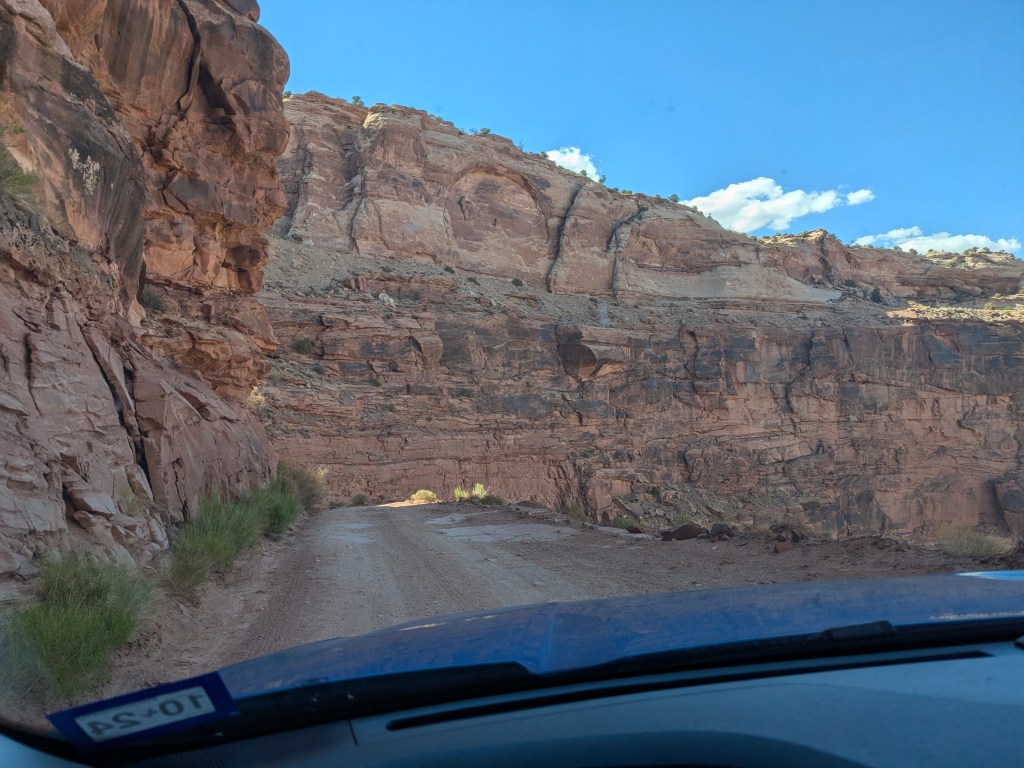
I didn’t take a lot of pictures during the descent for obvious reasons, but I did stop a few times both for photo ops and to rest my brakes, which I was riding hard. The straight parts of the road weren’t bad, but I confess some of the switchbacks turned my knuckles a bit white. Part of the problem is that I’m so short. At the best of times, my line of sight is just over the dashboard and hood. When the road was pointed sharply up or down and at the same time going around a hairpin curve, a lot of times I couldn’t see it, and had to “feel” my way around the corner… which is not very comfortable when there’s a sheer drop on one side, a wall on the other, and big rocks and potholes in between. I found myself stretching up in my seat as tall as I could to try to see where I was going.
But the views were absolutely spectacular, and I made it down safely to the canyon floor.

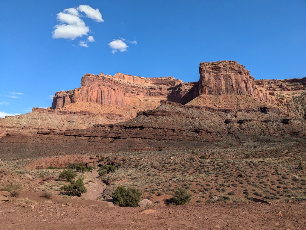
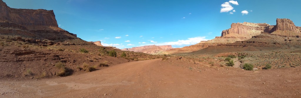
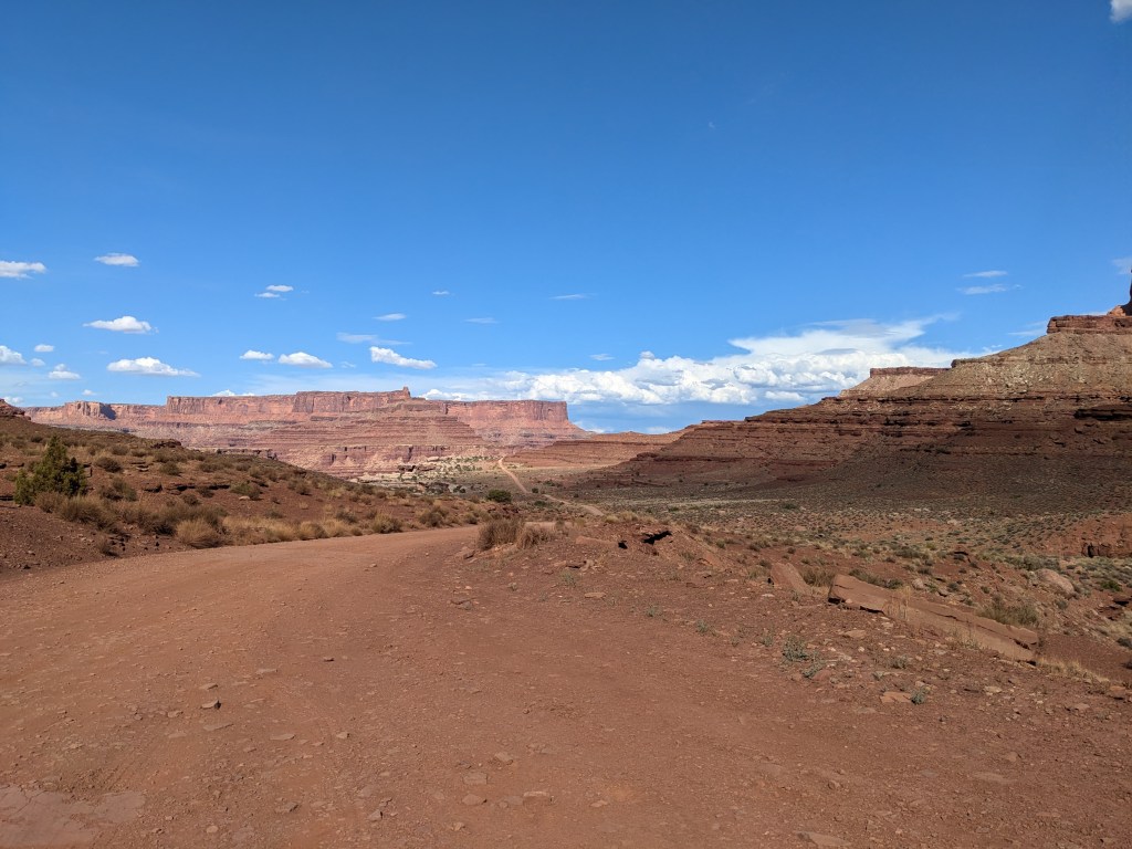

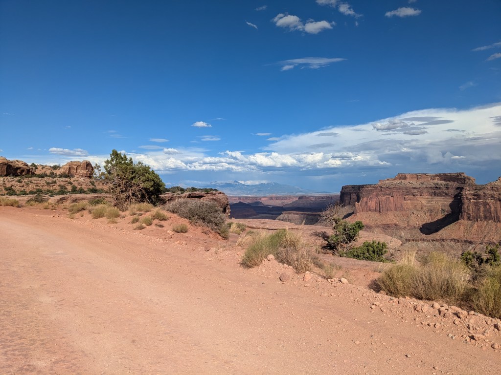
At the bottom, the Shafer Trail joins with the Potash Road which runs all the way across the floor of the canyon and up to the town of Moab on the other side, but that total drive is over 40 miles on gravel road (speed limit 15 mph). And rain clouds were starting to form over Island in the Sky. I definitely didn’t want to be caught down there in a storm. So I turned around and drove back up the way I came.

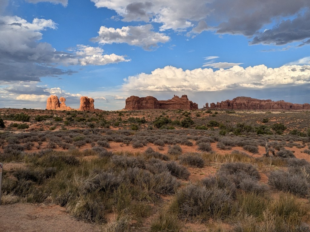
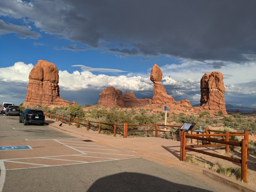
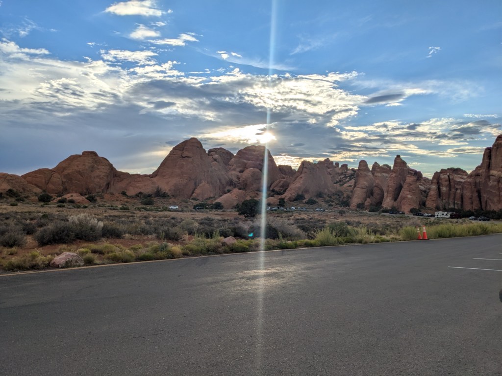
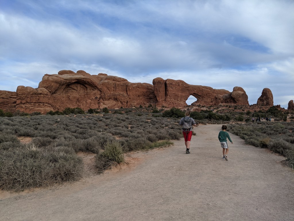
Once I made it back to the highway, I left Canyonlands National Park, but my day’s adventures weren’t over yet. When I was planning for this trip, I didn’t put Arches National Park into my calculations because technically I had already been there. In 2021, on my way home from a visit to the Dakotas and Nevada, my route happened to take me right by the entrance to it, and I “popped in” for a couple of hours on impulse. The parts I saw were impressive, but I didn’t see nearly the whole thing. Canyonlands and Arches are actually very close together (so much that they are part of the same Guide Along tour), so I decided to go back to Arches to see the sun set there.

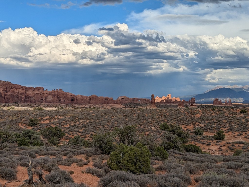
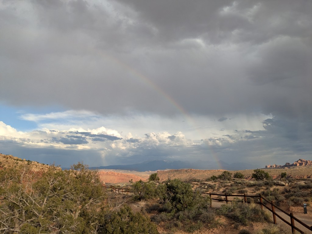
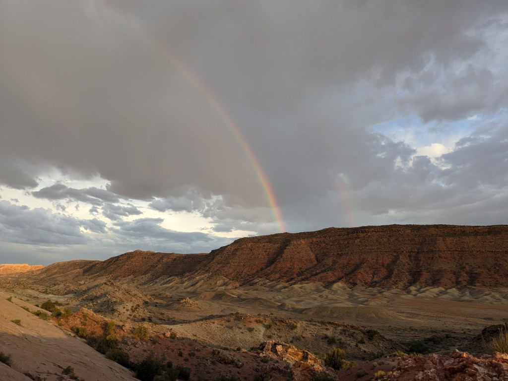
I think my favorite “arch” in the park was the rainbow that formed where the sunset struck the intermittent afternoon rainclouds.
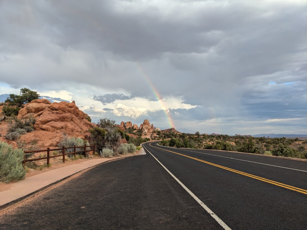
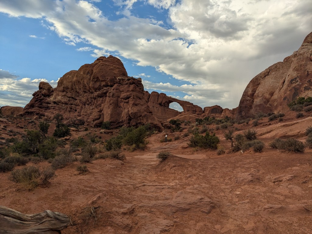
“Devil’s Garden” is at the end of the road. There are apparently some more dramatic arches if you hike back in there, but I was still not prepared for a long hike and it was getting too late in the day anyway. There are actually over 2,000 different arches recorded in the park… fortunately at least some of them are visible from the road!
Back down a side road on the way back to the park entrance, I did change into my Crocs (as it was drizzling) and do a short-but-steep hike to a vantage point where I could see Delicate Arch, the state symbol of Utah. (I actually kind of got tricked into it. I thought I was walking to the Lower Viewpoint which was supposed to be flat, but I started up a trail and found myself on the way to the Upper Viewpoint. By the time I realized my mistake, I’d done enough climbing that I kept going so as not to waste my effort!).

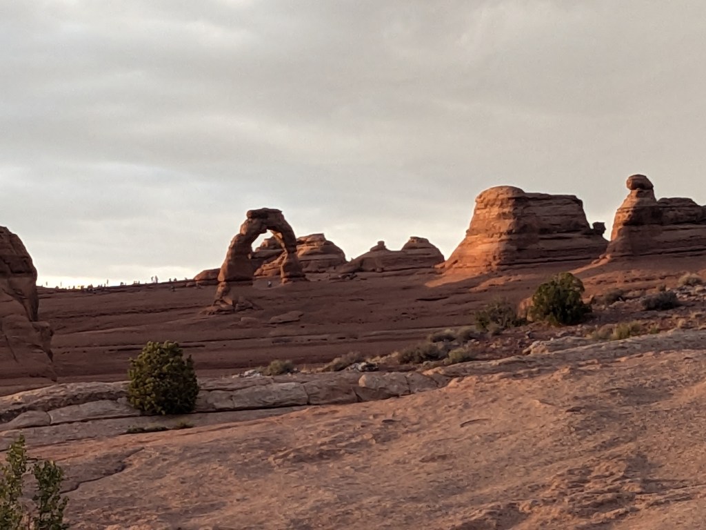
A different trail takes you right up under the arch, but that’s a much longer walk.
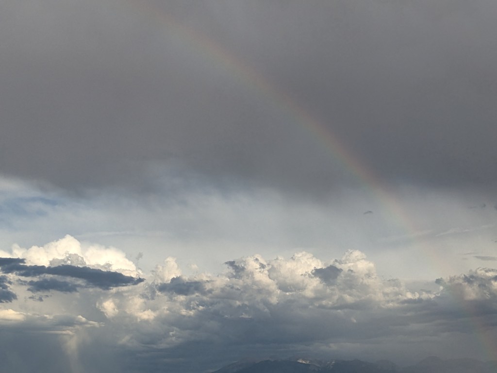
The previous rainbow had faded, but a new one appeared, and even made an effort at being a double.


I ran out of daylight before I made it back to the famous Window Arch, but here’s a picture from my 2021 visit.
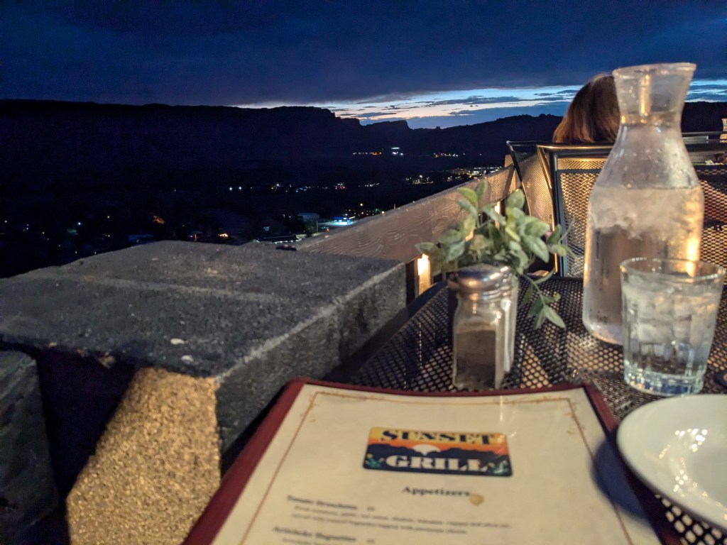
Since I wasn’t too far from Moab, I went into town for dinner. Guide Along had mentioned the Sunset Grill, perched on a bluff above the town in the former home of Charles Steen, the eccentric Uranium Billionaire who made his fortune in mining.
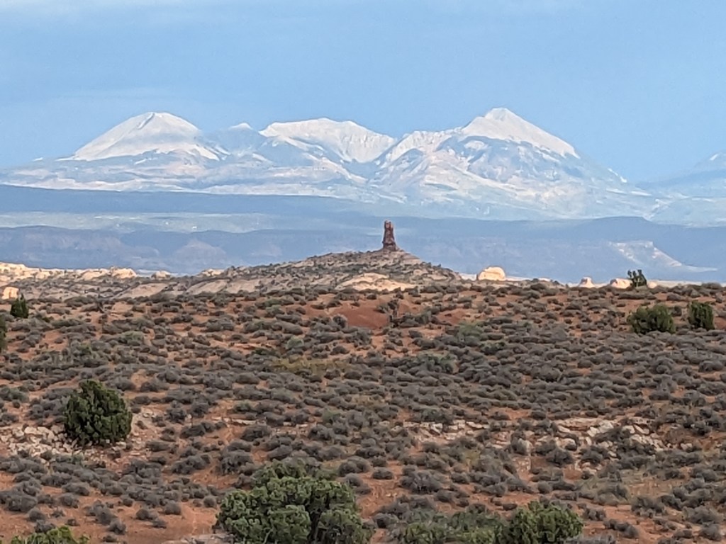
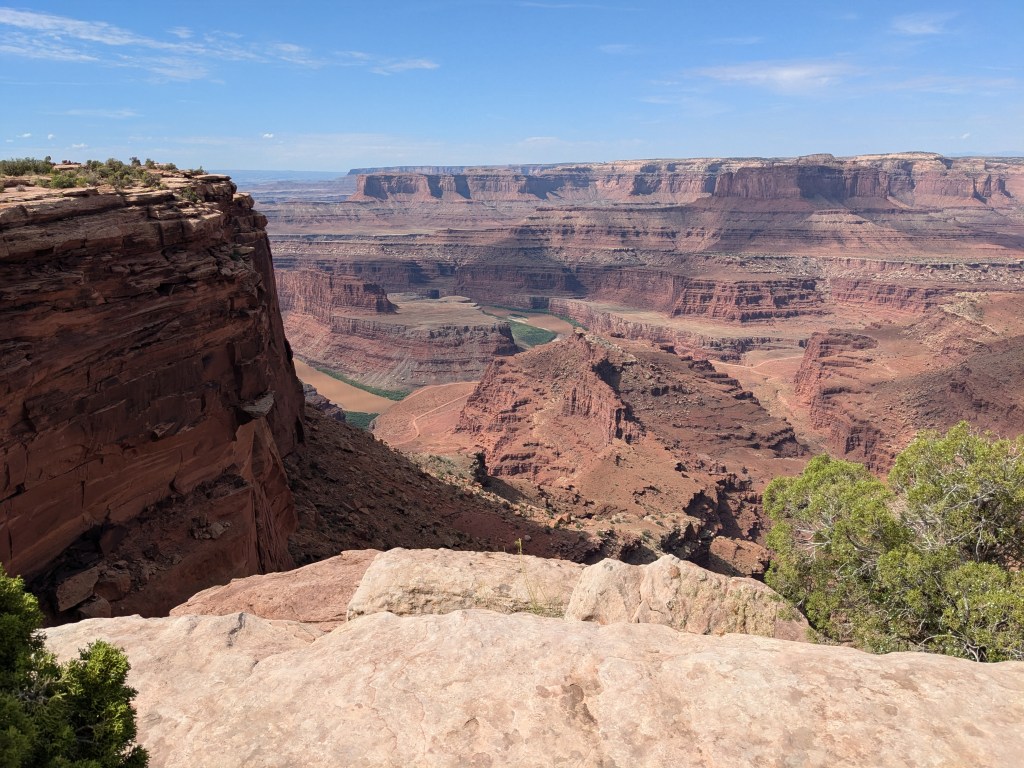
Tuesday morning, my task was to hitch up the RV and drive on to my next stop in southwestern Utah. But first I had to squeeze in a visit to Dead Horse Point in my own campground park. Despite its awful name, the Point is actually just a smaller version of Island in the Sky, a high mesa connected to the same canyon rim across a narrow neck of land, and looking out at a similar view. But it offers a much better view of the upper Colorado River. (In fact, I was probably looking up at it from the Shafer Trail when I was on the canyon floor, although from that angle it’s hard to pick out from the other points on the rim.)

After that, I pulled out for the five-hour drive to Camp Lutherwood near Alton, Utah. I am booked in here for a full month, since it offers access to Capitol Reef, Bryce, Zion, and Great Basin National Parks. Look for those reports on upcoming weekends!

Leave a comment