Good mortereve. Since last we met, I’ve visited Bryce and Zion National Parks, but each visit has been something of a “half visit” so I waited to blog them together.
As I planned for these two parks, I knew I wanted to do something “different” in each of them. I’ve done an awful lot of drive-by sightseeing lately, and a little bit of hiking, but as I said in a previous post, I’m really not a fan of desert hiking. I was looking for other options, and I found two: horseback riding and cycling.
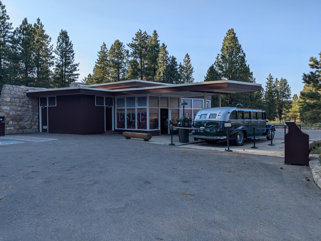
Both parks actually have both options available — guided horseback trail rides and bikes for rent. But I found that Bryce has a five-mile paved multi-use trail for cycling, and rents e-bikes inside the park from a “Historic Service Station” (repurposed 1940s-era gas station) that’s right on the trail. So I decided that I would bike in Bryce and do a trail ride in Zion.
Bryce also has a place named “Sunrise Point,” which inspired me to get there early in the morning to watch the sun rise over the canyon. Since my campsite is almost an hour away from the park, this meant getting up VERY early, while it was still purely dark out. But unlike my failed attempt to do this for Capitol Reef, this time I really did get up on time.
One complicating factor was that I wasn’t feeling very well. I’ve had a lot of nasal congestion since I got to southern Colorado…. I think I may actually be allergic to the desert, or maybe it’s just the super-dry air. But the day before my Bryce visit (Friday, August 16) the congestion got worse and started to feel like a sinus infection. Those things make me miserable and also make me nauseated from too much mucus (sorry for TMI). So I wasn’t feeling my sharpest when my alarm went off Saturday morning, but I was determined to go anyway.
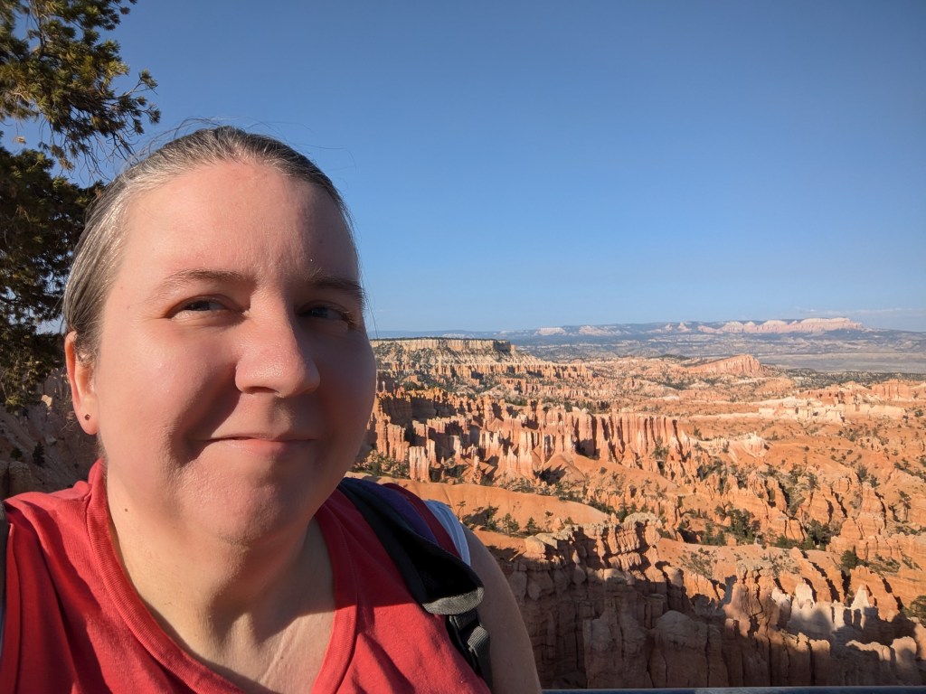
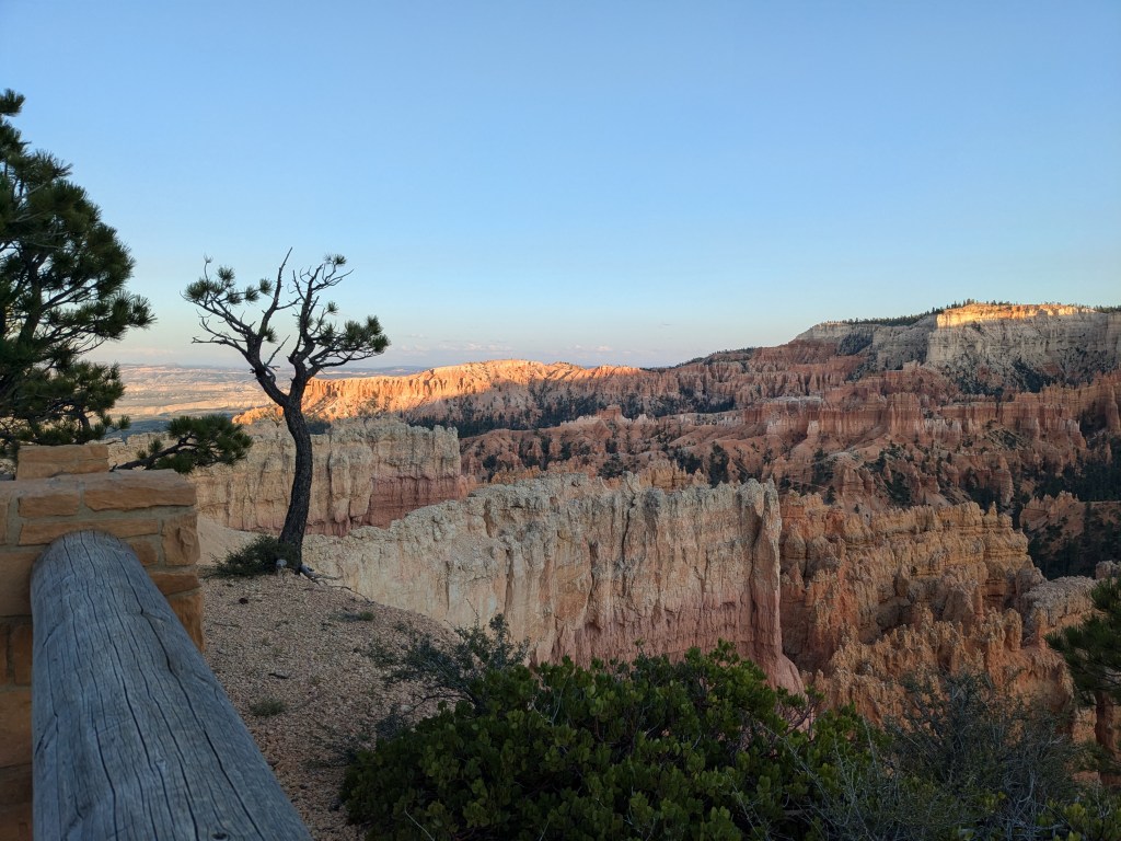
I did, in fact, make it to the general vicinity of Sunrise Point in time to watch the sun rise, and it was glorious. I took a ridiculous number of pictures, but I’ll try to curate some of the best for you here.
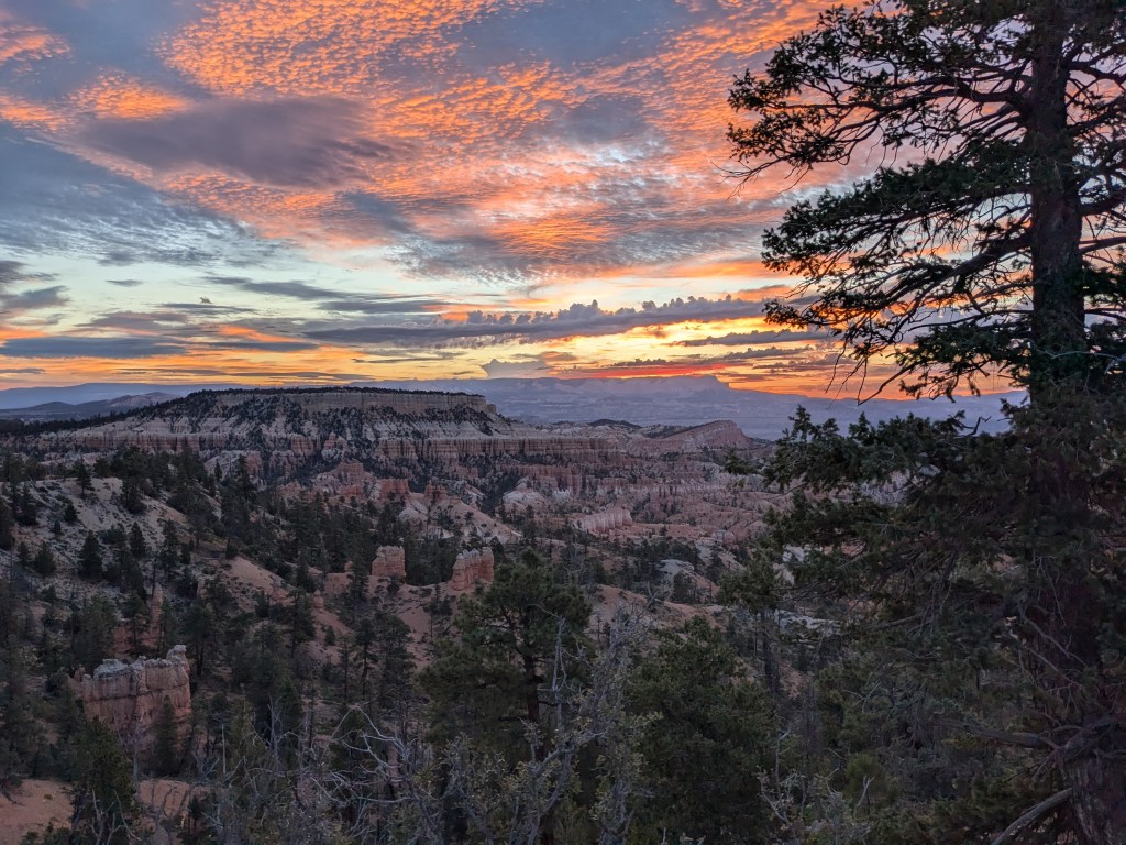

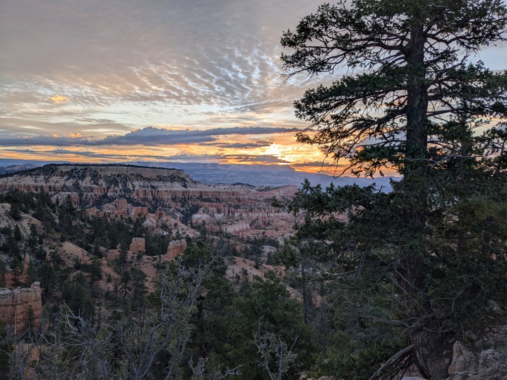
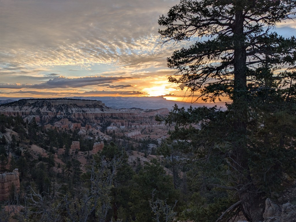

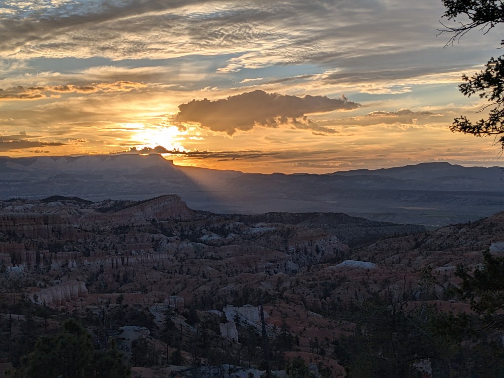
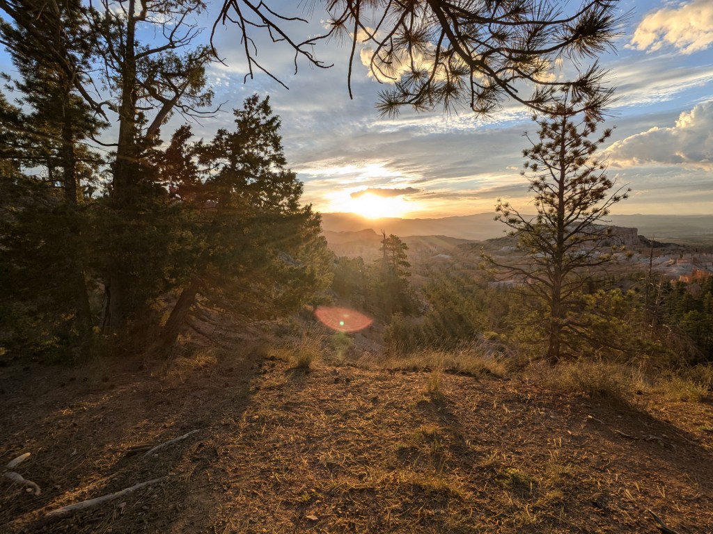
I say I was “in the general vicinity” of Sunrise Point because I discovered after the fact that the promontory of that name was actually the next one down from where I was standing. Bryce doesn’t do a very good job with signage, frankly. But my view was still amazing, and probably less crowded than it would have been at the actual Sunrise Point. I was VERY far from being the only person out there to watch the sun rise; it seems a whole lot of other people had the same idea.

What’s been interesting to me, in all my visits to the Utah parks, is how many of the guests are speaking a language other than English. I’ve heard Spanish, French, German, Italian (I think), and a bunch of other languages I can’t even begin to identify. I’m not sure what this group was speaking, but it definitely wasn’t a language I recognized. I would go so far as to say that a majority of park guests are speaking something other than English, and at times I have a surreal feeling that I’m traveling in another country. But it just goes to show that these parks have true world renown, and people come from all over the earth to see them.
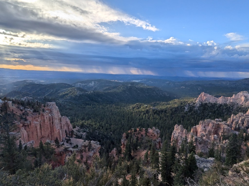
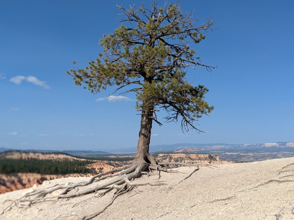
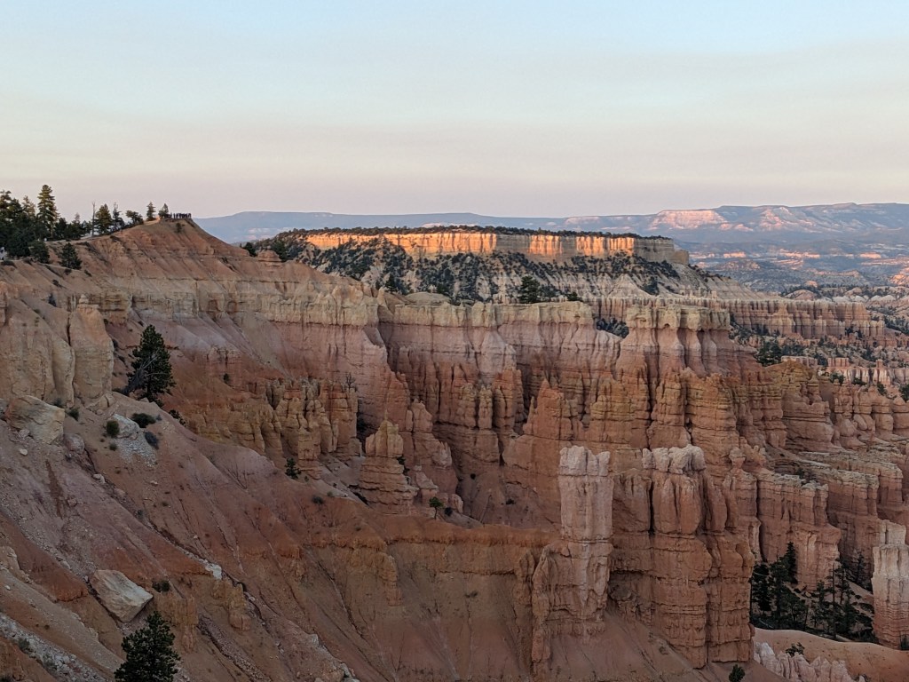
I should back it up a little bit and describe the general layout of Bryce Canyon NP so that you can follow my travels. The canyon (which, I learned, is not geologically a canyon because it doesn’t have a river in it… I didn’t even know that was a requirement!) runs roughly north to south. The park entrance is at the north end of it, and the main park road runs south parallel to the western rim. The canyon rim is really like a ridge, dropping away gently to the west into pine forests on a high plateau, and falling as sheer cliff walls into the canyon itself on the east. Much of the main park road, and the multi-use trail that runs roughly parallel to it for the first five miles, are thus not in sight of the canyon. They run through woods of ponderosa pine and occasionally veer close enough to low places in the rim-ridge to see the astonishing view beyond.

There’s a cluster of popular overlooks at the north end of the park, connected by the multi-use trail, and then a long drive to the south with some possibly less-visited overlooks. By the time I had finished watching the sunrise, I had a choice to make. I wanted to rent an e-bike and explore the multi-use trail at the north end, but the bike rental place didn’t open until 10:30 a.m. So I decided to bypass that part of the park and drive down to the southern end.
This was a good choice. I left behind the crowds at Sunrise Point and drove down into an area that had practically no visitors yet. There was one German couple doing the same thing I was… we ran into each other at a couple of the overlooks and exchanged picture-taking services. But otherwise it was tremendously quiet. If I stood still, I could hear the wind blowing, the scurrying of small creatures, and the calls of birds.

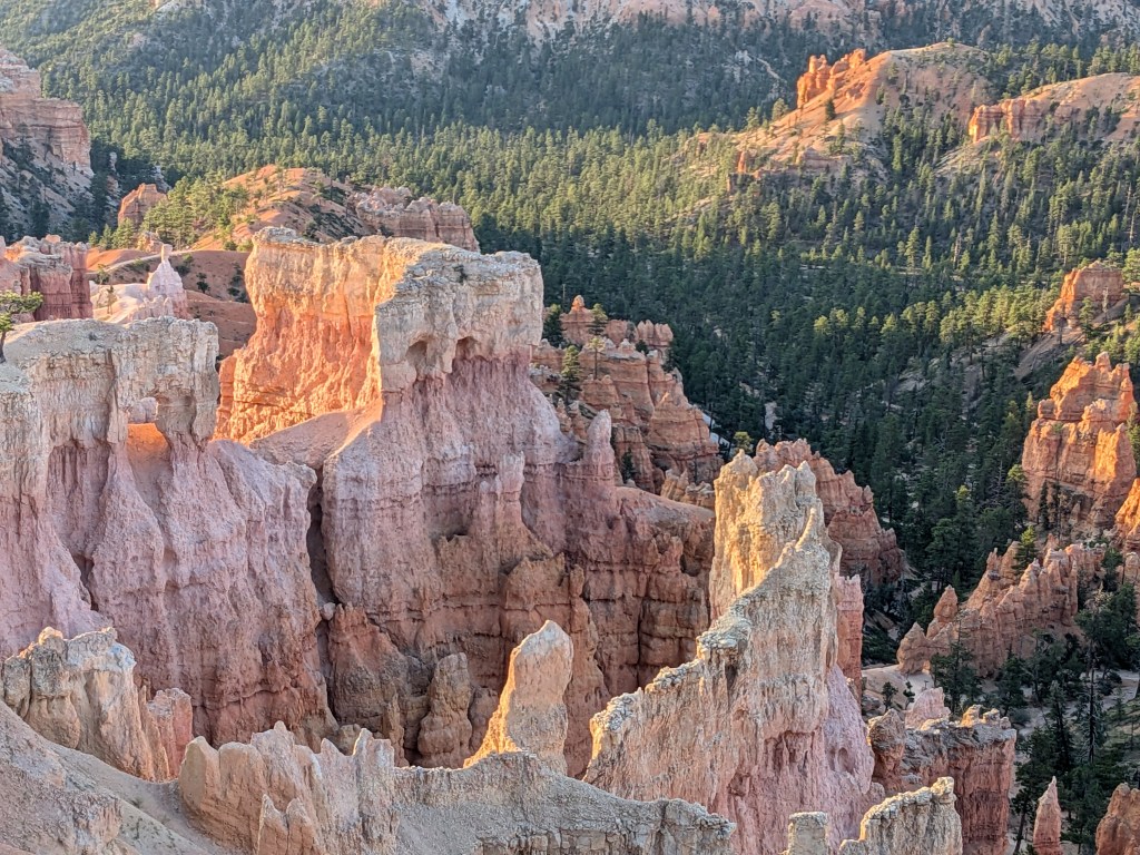
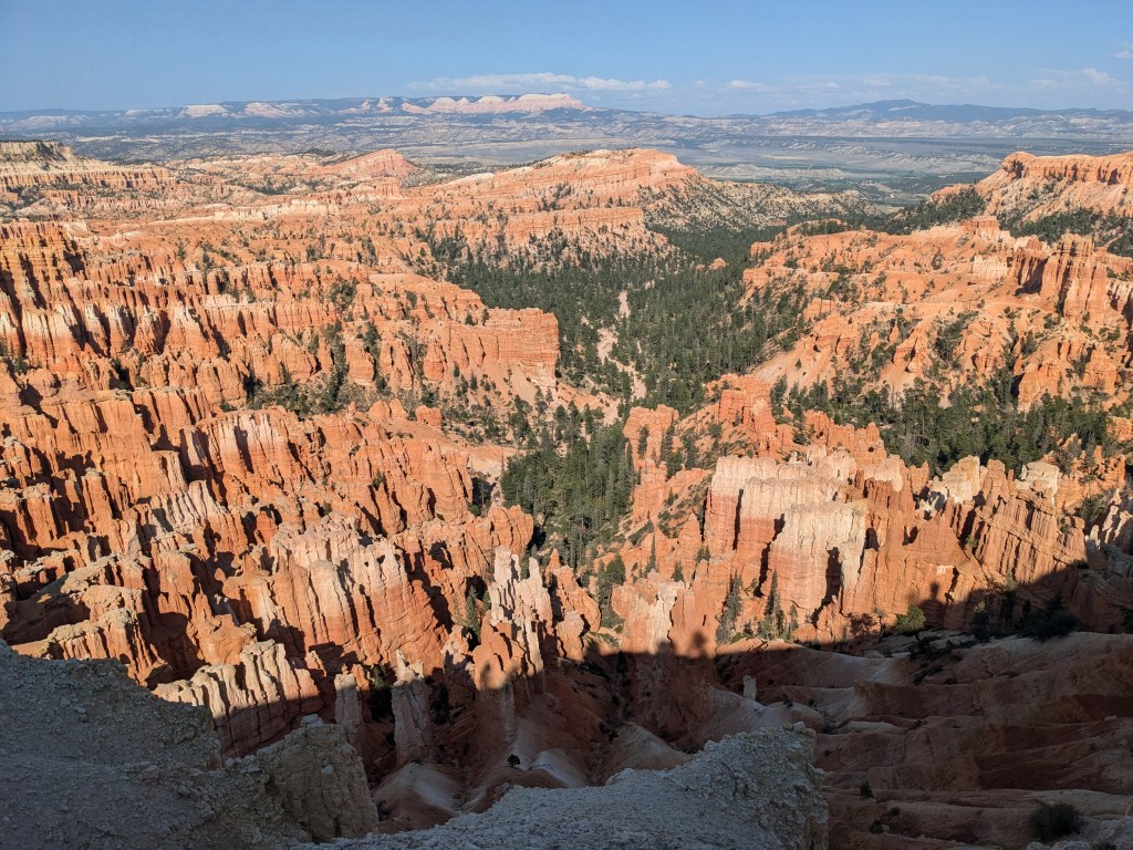
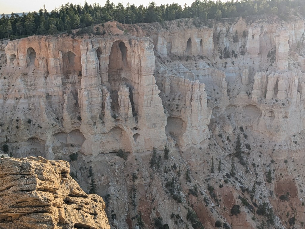
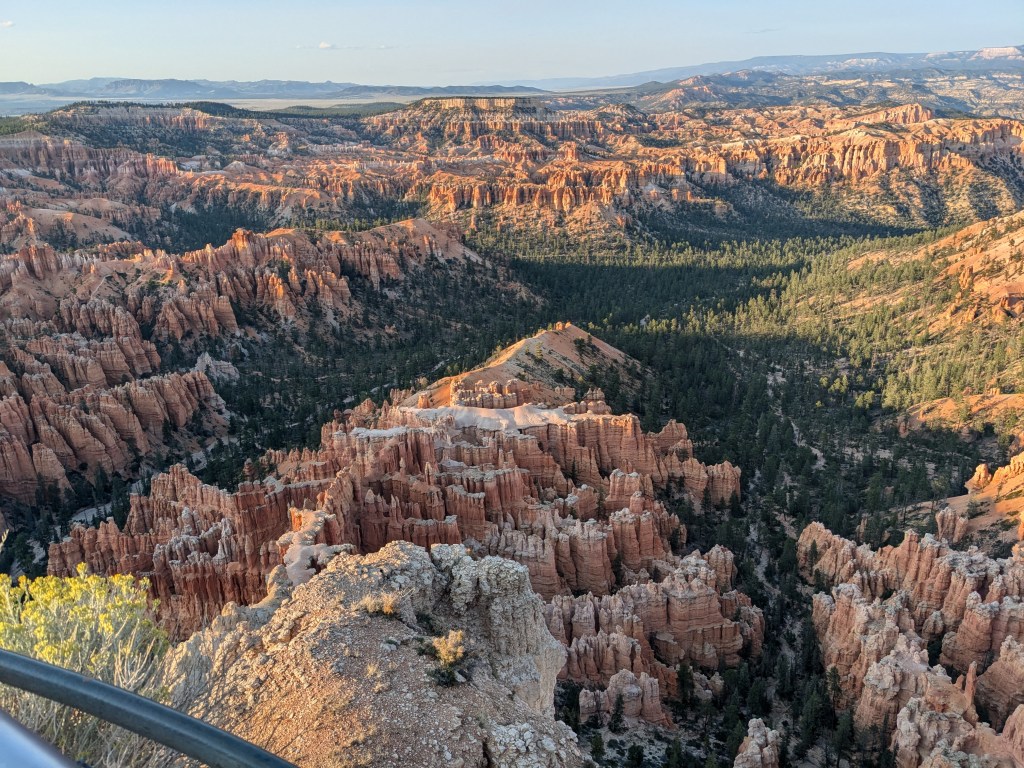
The canyon itself is known for its hundreds of hoodoos, vertical rock formations created by freeze-and-thaw “ice wedge” cycles. There are also some arches and cavernous indentations in the rock. The predominant rock colors are red and white, which, with the dark green trees that grow throughout the canyon, make “Christmas colors.” It’s a striking landscape.

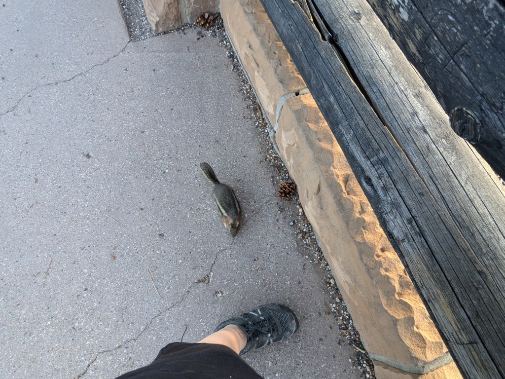
The park is inhabited by mule deer, striped chipmunks, and a variety of birds. I was especially impressed by how the chipmunks were utterly at home on the very brink of the canyon and down over its edge.


As I headed south, clouds began to roll in over the east rim of the canyon, making the scenery even more dramatic. Lightning was flickering across the clouds, but I didn’t manage to get photos or video of that.

This chipmunk at one of the overlooks was particularly fearless, and also quite rotund. I’m thinking she might have been an expectant mother.

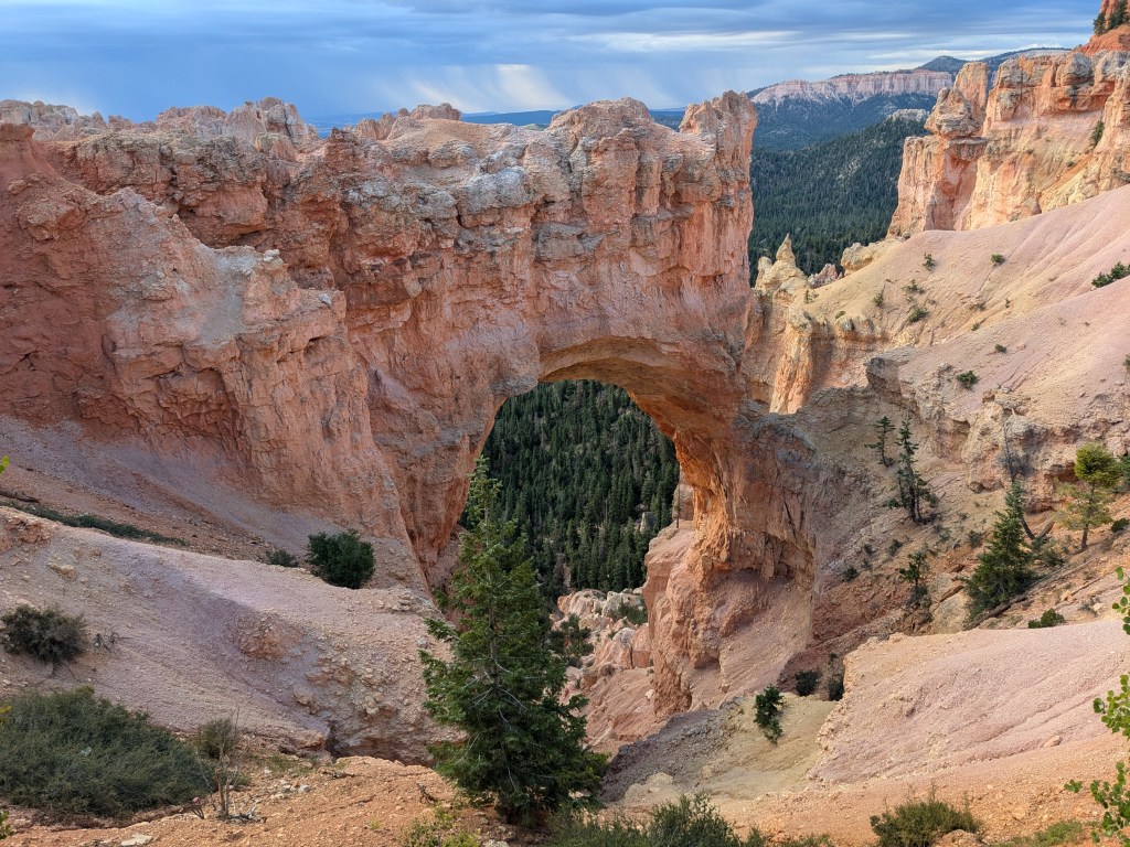
I especially liked the Natural Bridge formation, an enormous arch near the canyon rim.

This raven sang me the song of his people in dramatic fashion.

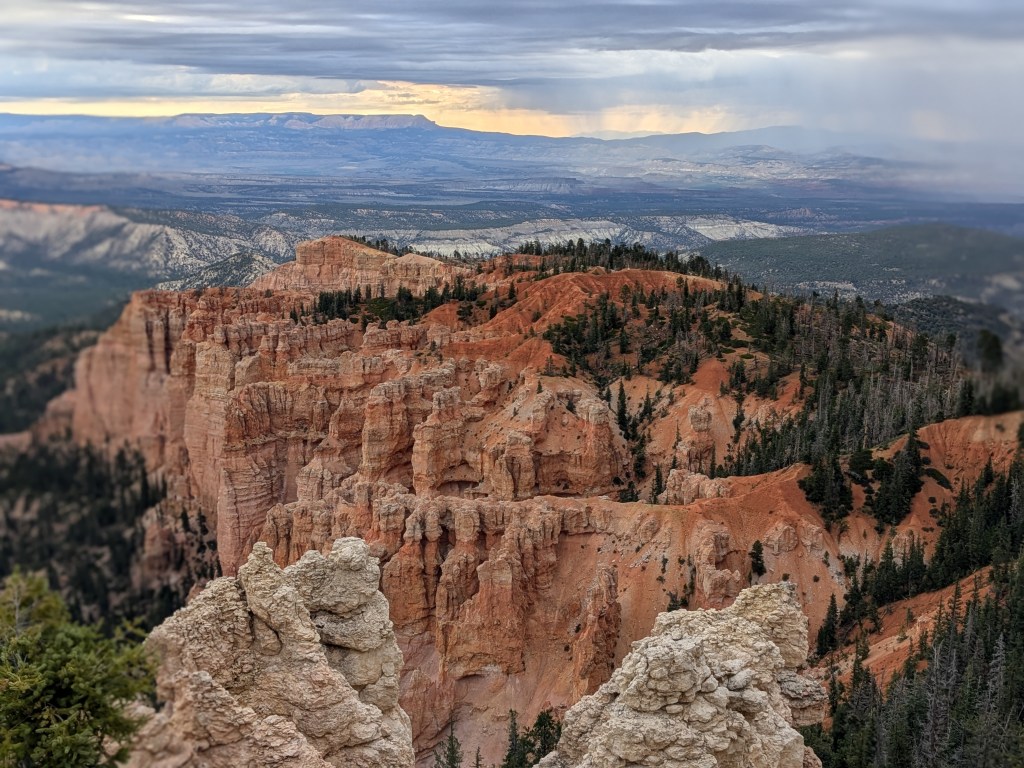
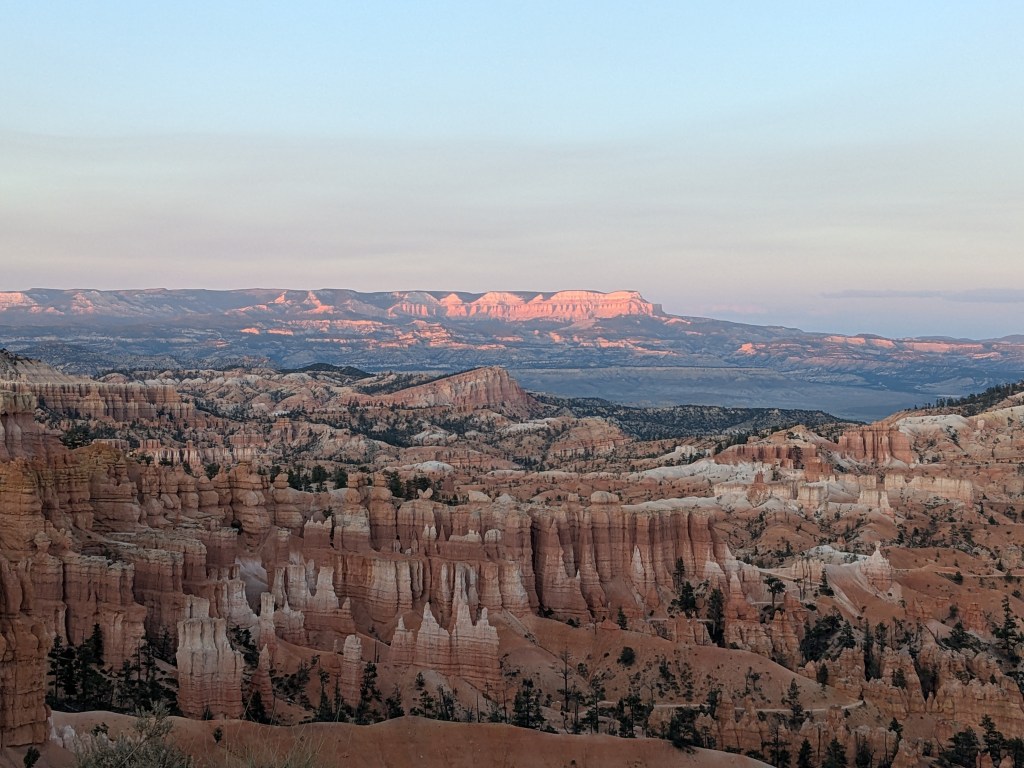
Rainbow Point, at the southern end of the road, showed off its colors.

Unfortunately, at this point, the nice German couple and I got caught in a shower of rain that came across the canyon and poured down on us. With lightning also in the equation, it was time to get under cover. I got back in my truck and drove back to the Visitors’ Center, and looked at a few exhibits. By this time, it was still only about 9:30 a.m. The weather was iffy, alternating rain and sun, and it would be another hour before the bike rental opened. Also, I was incredibly sleepy. There was “I got up really early this morning” sleepy, and then there was “I’m coming down with something” exhausted.
I had only done half of what I wanted to do at Bryce, but it occurred to me that since I was camped less than an hour away and had another couple of weeks in the area, I could always come back later. So I decided to make it a “half-visit” to the park and do the other half later in the week.
I went back to my RV and slept for most of the day on Saturday and Sunday, feeling increasingly yucky, and didn’t really start to feel better until Tuesday or Wednesday. The opportunity to return to Bryce just didn’t come during that week. In between my ongoing sinus infection and a change in the weather that brought two days of cold rain, I didn’t make it back there before my scheduled visit to Zion on the following Saturday.
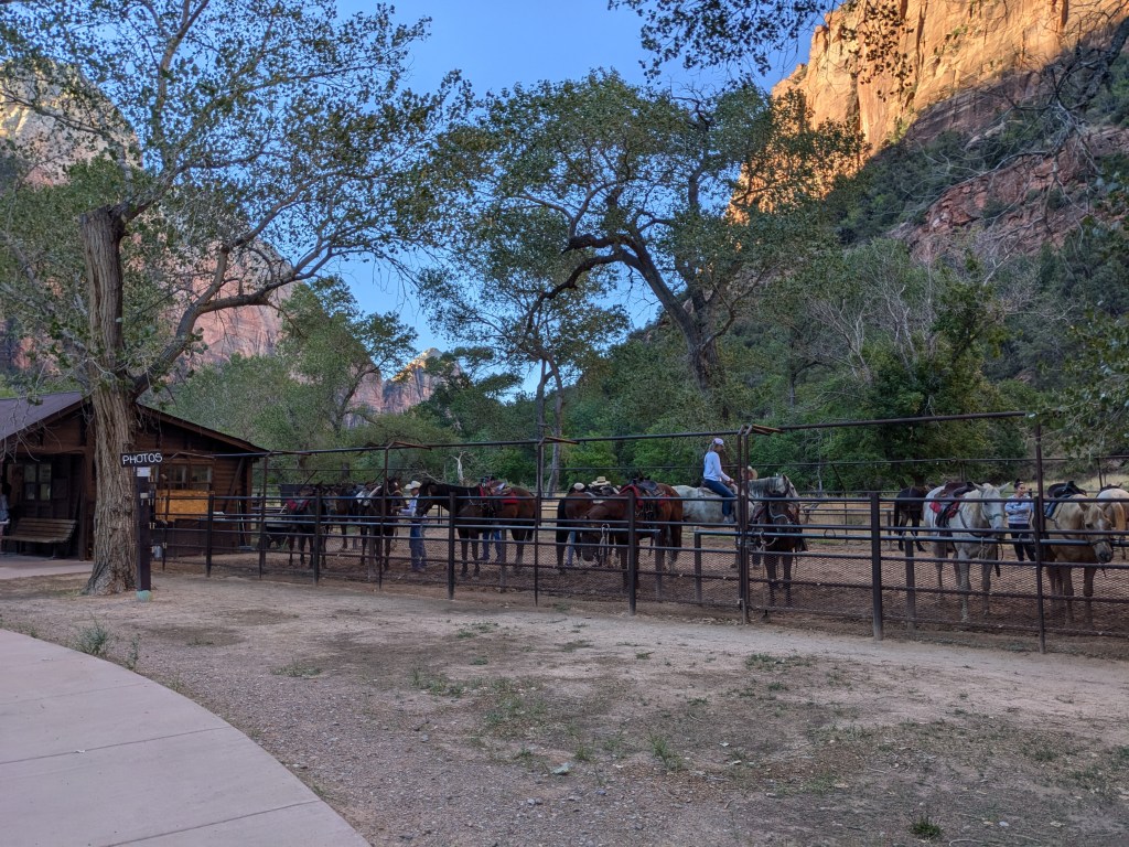
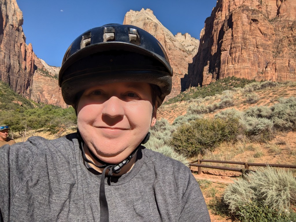
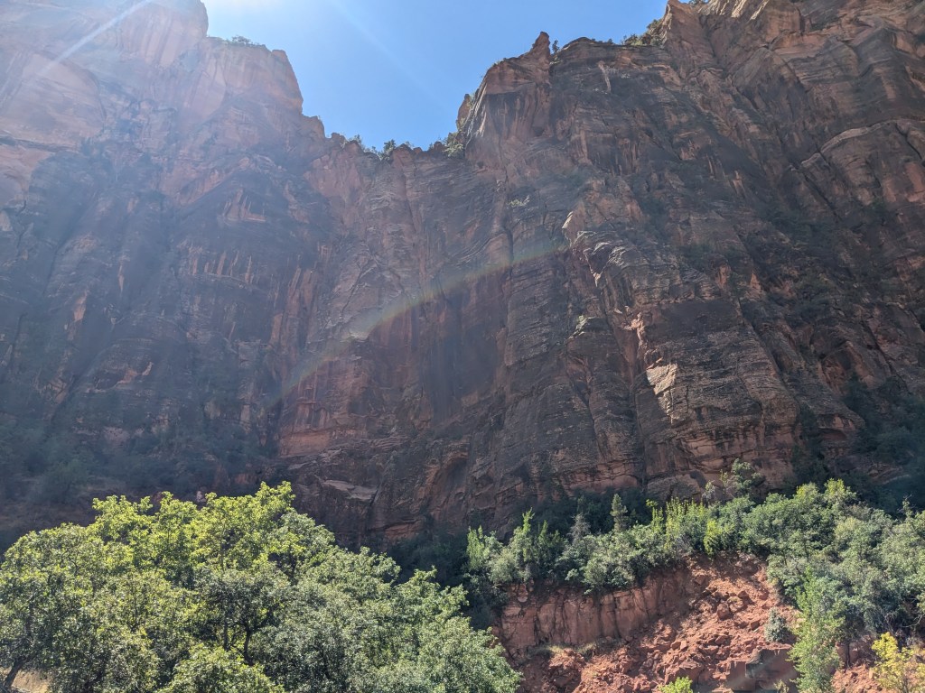
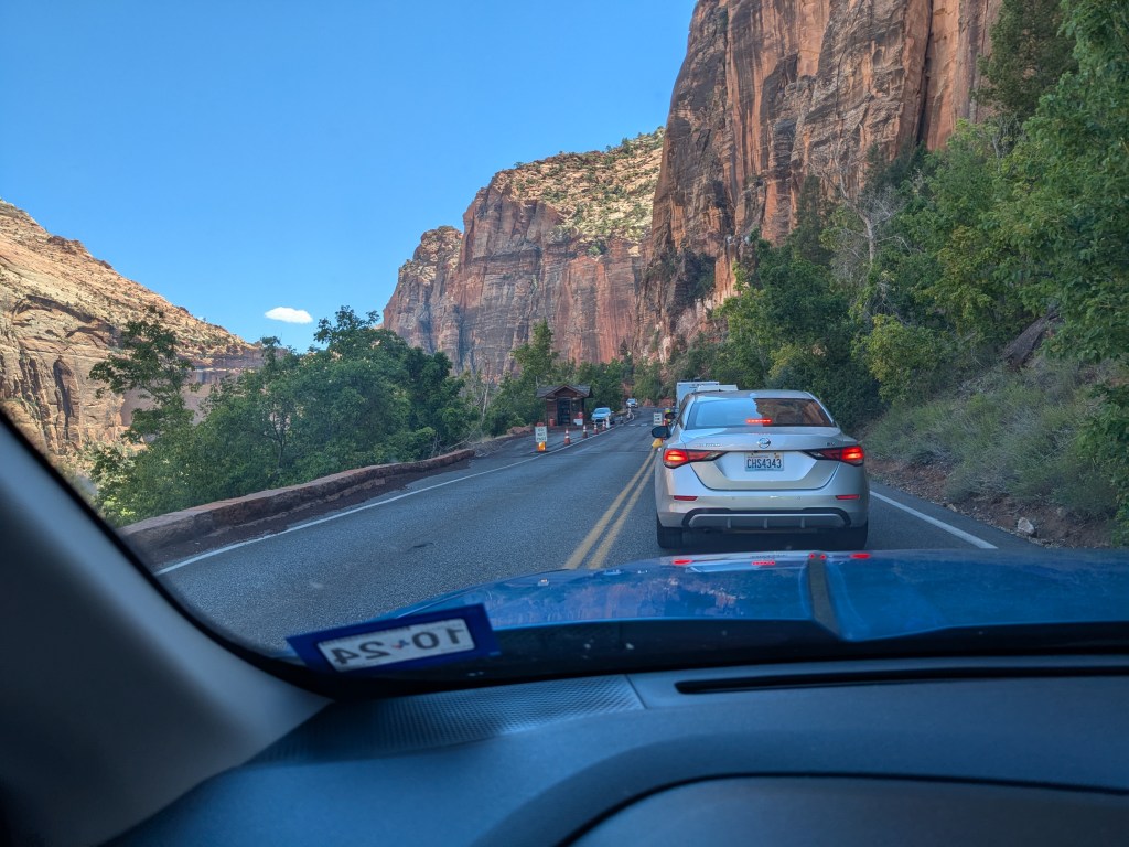
I had booked my trail ride in Zion for 9:30 a.m., figuring it would be more pleasant to do it before the day got too hot, so I had another early start to make. Whereas Bryce is northeast of my campground, Zion is a little over an hour to the southwest of it. The park has entrances to the east and the south. Route 9, Zion Park Boulevard, runs west from US-89 through the canyon into the park and then bends sharply south to the south entrance in Springdale, Utah. At the point where it bends, there is a road to the north, Zion Canyon Scenic Drive, which connects most of the park’s scenic points. However, Zion Canyon Scenic Drive is closed to most private car traffic as a way to keep the park from being completely overrun by the enormous crowds that come there. Unless you have special permission to drive on it, you have to park at the Visitors’ Center just inside the south entrance, or in the town of Springdale just outside the entrance, and take a shuttle on the Scenic Drive.
As it happens, I did have special permission to drive on part of it, since my trail ride started from a corral about halfway along it. (My parking pass was very specific that I was only allowed to drive to that spot, park, and then drive back out as soon as my ride was done.) The trail ride was to start from the Emerald Pools area and go south about a mile to the Court of the Patriarchs. The whole thing was scheduled to take an hour.
I should take a moment to explain my riding experience, or lack thereof. I was a horse-crazy city child, but without many opportunities to actually ride or even be around horses. Summer camp, birthday parties, ranch pony rides… I took whatever I could get, but it wasn’t much. I took one semester of Horsemanship in college (hurrah for school in Thoroughbred country!) and learned a few riding fundamentals. As an adult, I’ve managed a little riding here and there…. arena riding on friends’ horses, and trail rides at various vacation spots… but never enough to really be comfortable at more than a walk. Then I went to Australia in 2018 and in a fit of madness booked myself on a two-day trail ride through the mountains. I was in SO far over my head that it wasn’t even funny. It didn’t help that the Australian and American ideas of a “trail ride suitable for beginners” were quite different… Australians think that includes cantering up mountain roads. I really couldn’t keep up with the group and was holding them all up, so the wrangler ended up taking me off on my own and nursing me along at a slower pace. Even then, all my muscles were fiery jelly by the time we reached our destination. It was an amazing, beautiful, exhausting, humiliating, incredible experience that I’m glad to have had and never intend to repeat. In the six years since then, I think I’ve been on a horse once — an American-style novice trail ride at a gentle walk. Whatever saddle muscles I may have had have long since disappeared, and my knee and ankle joints aren’t as young as they used to be… as I was about to discover.
I got checked in and mounted up on Shadow, a short-ish bay gelding. He seemed docile enough, but ominously, one of the wranglers handed me a riding crop and told me to use it if he was being “stubborn.” I’ve never used a crop on a horse before and didn’t end up using it on Shadow, but I would have given him a little smack with it if he had stopped and refused to go on. As it turns out, that wasn’t our problem.
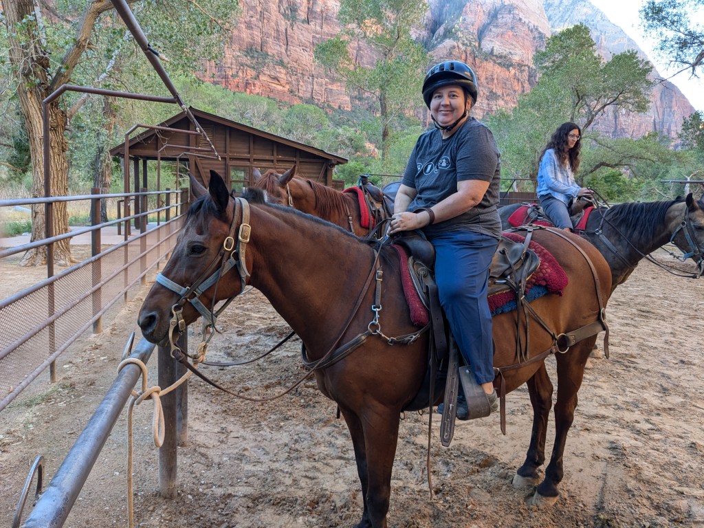
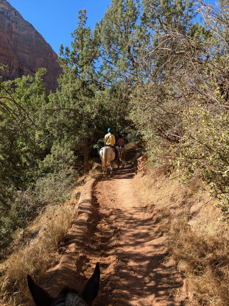
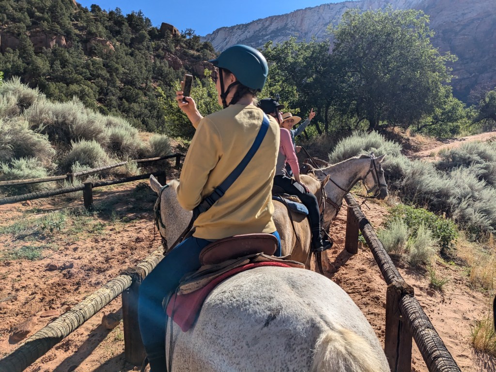
Our trail ride consisted of one wrangler in the lead and five guests, of which I was third in line. The two women ahead of me were clearly highly experienced riders. They turned up in jodhpurs and riding boots, and made comments about how their mounts reminded them of their horses at home. Talk about an instant inferiority complex. The couple behind me were apparently even less experienced riders than me; the woman (in the rear, and visible in the picture above) said that she hadn’t been on a horse at all since childhood.
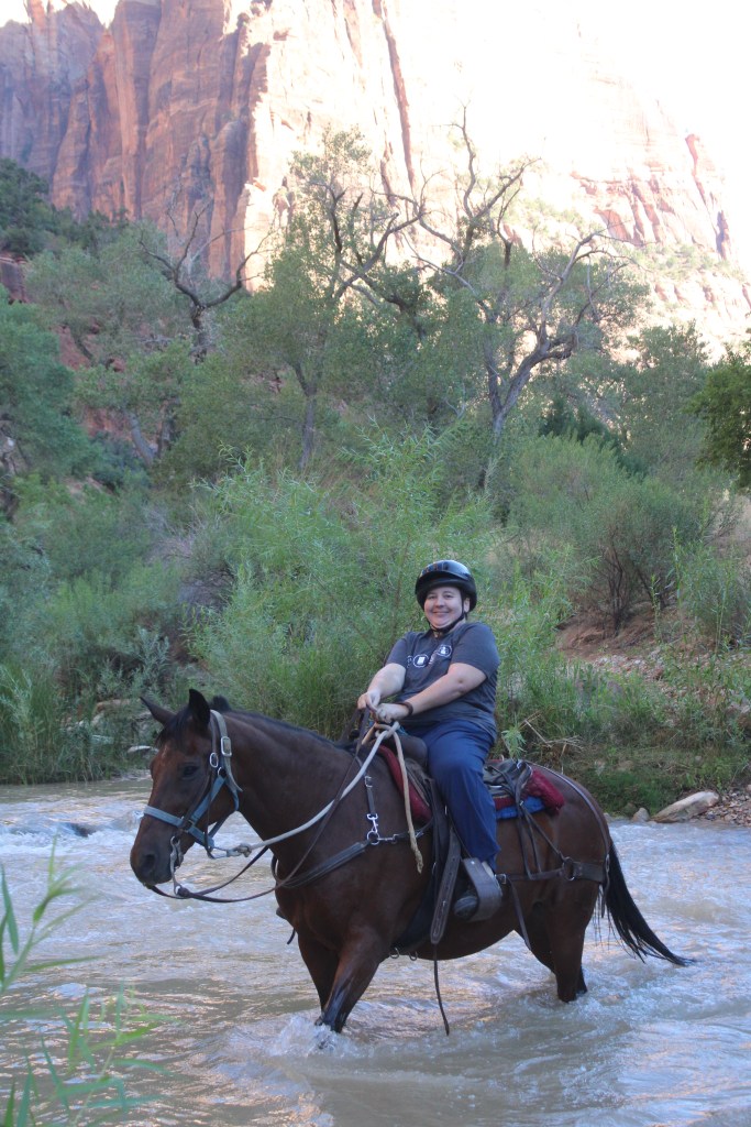
We set out, and almost immediately rode through a ford in the Virgin River. A photographer was on hand to take our pictures (which they sold to us for $10 at the end). Please ignore my poor form here… I know I’m leaning too far back. The river bottom was pretty uneven and I was trying to keep my balance and look at the camera at the same time.
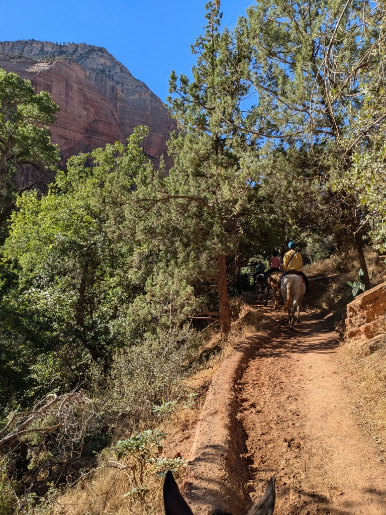
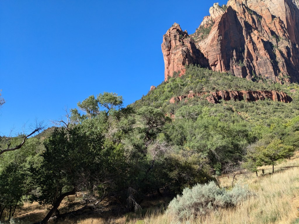
I didn’t get to take a ton of pictures during the ride because I was focused on riding. But the scenery was certainly memorable, and I at least caught a few along the trail.
I had two main problems during the ride. The first was the unfitness of my own body. The wrangler had shortened my stirrups to the proper length for western riding — that is, my feet made solid contact with the bottom of the stirrups so that I could sit with my knees bent and the soles of my feet parallel to the ground, distributing my weight between the seat of the saddle and the stirrups. This means that your ankles and knees stay flexed, rather than your legs dangling loose along the horse’s side. Unfortunately, my joints did not take kindly to this. They were in a lot of pain before we even reached the halfway-turnaround point, and were halfway numb by the time we finished (an improvement?). That gave me some anxiety about what would happen when we dismounted. At the first rest stop on my Australia trip, my legs had gone so numb that I fell flat on my bottom when I got off because they wouldn’t support me, which was both unpleasant and embarrassing. Thankfully that didn’t happen this time. It would have helped if I could have moved my feet around a little more to at least change the angles, but I was worried about losing my stirrups or having my foot slide all the way through because I was wearing heelless sneakers, absolutely the wrong footwear for horseback riding. I knew that going into it, but I’ve just about eliminated anything with heels from my wardrobe because they’re unhealthy for walking.
The second problem was with Shadow. He was very well-behaved, but he is SLOW. We were told to keep our horses 3-4 feet apart. You can tell from my pictures above that I did not succeed at that. I have a lot of empathy for poor little Shadow because I, too, tend to walk slower than my friends, and then have to jog to catch up. The wrangler kept looking back and calling, “Come on, Shadow” and I did my best to speed him along with lots of clucking and leg-squeezing. At first he would quicken his walk fractionally. But the one time he broke into a trot, I pulled him up immediately. We were told in the safety briefing not to trot, because it would make the horses behind us trot too, and I didn’t want to do that to the inexperienced riders behind me. (The horse right behind me also had a reputation for slowness, and lagged even behind Shadow at times.) After that, Shadow decided I wasn’t serious about going faster and pretty much just ignored me when I told him to quicken.
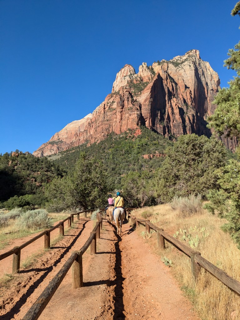
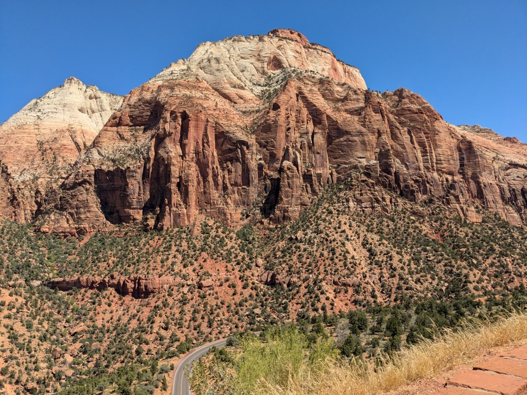
But we made it to the halfway point, the Court of the Patriarchs, and paused long enough to get some good pictures.

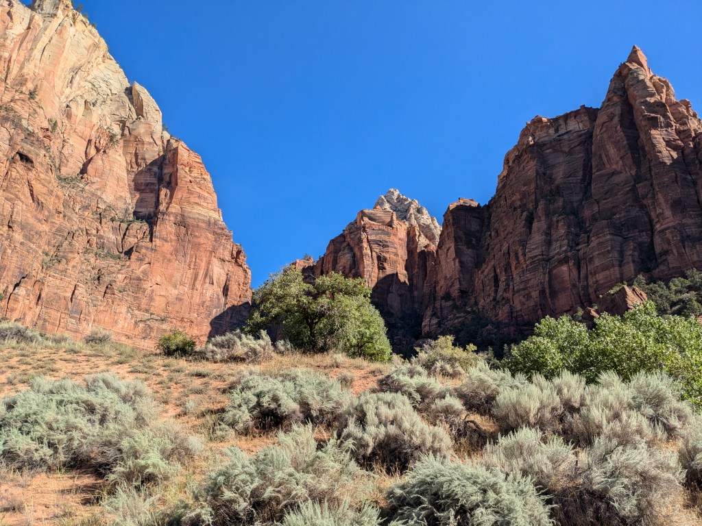
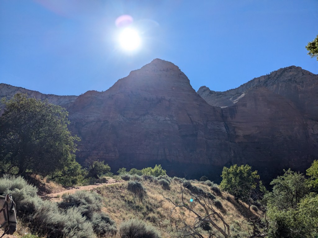

According to our wrangler, a Methodist minister came through the area and named the peaks Abraham, Isaac, and Jacob after the biblical patriarchs. Then, not to be outdone, the Mormons came along and named Mount Moroni. It’s definitely some impressive scenery.
I wish I could have enjoyed that ride more. The two experienced riders ahead of me were laughing and talking with the wrangler, and the two novices behind me at least seemed to be managing ok. The weather was perfect and the trail was beautiful. But I was just so sore, and so frustrated with trying to keep Shadow up with the group, that I didn’t get to relax and enjoy it as much as I would have liked. I’m just being honest here. It didn’t improve matters that when we got back to the corral, the experienced riders executed graceful, light, perfect dismounts while I slid off my horse like an uncoordinated avalanche. But at least I didn’t fall flat on my butt.
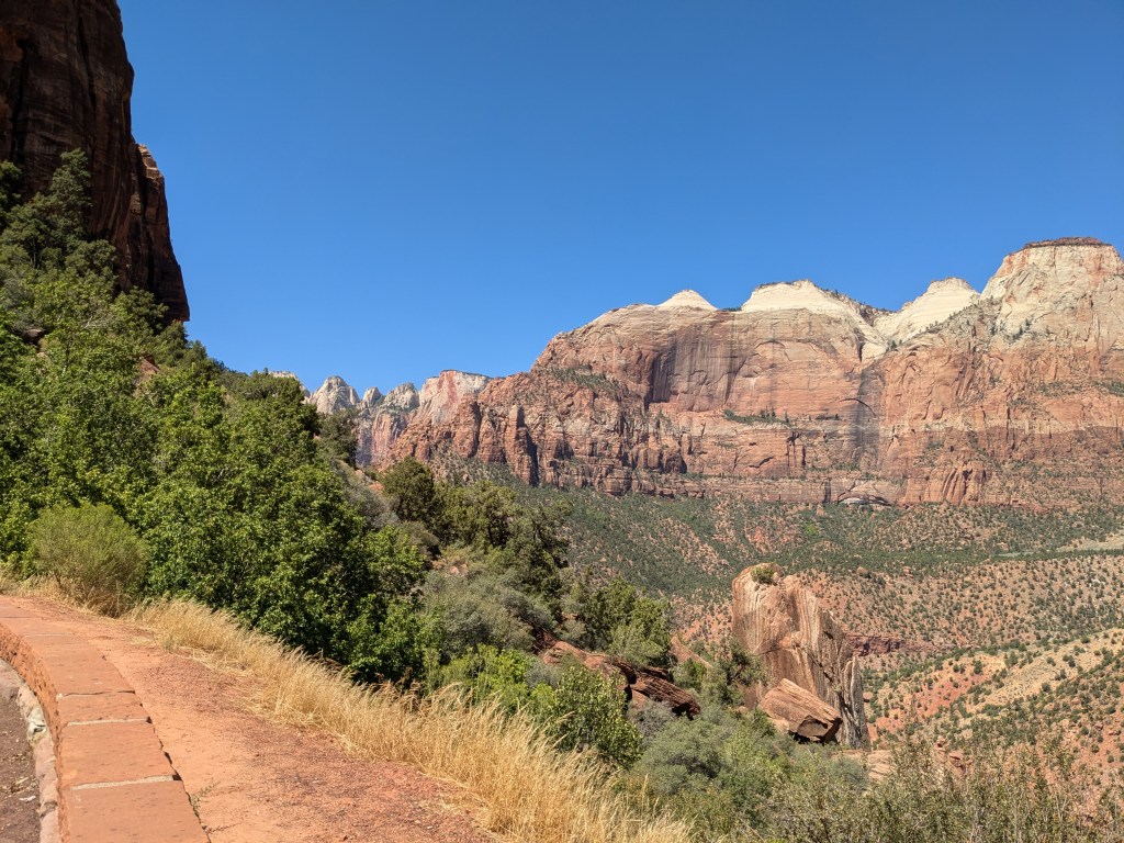
After we were done, I drove down to Springdale right outside the southern park entrance and got some lunch. My plan after that was to take the shuttle back into the park to see more of it. Unfortunately, that’s where I hit a snag. Zion is a VERY popular park, especially on a late-summer Saturday, and I literally couldn’t find an open parking space anywhere around the Visitors’ Center. The park’s advice was to go back into Springdale and pay for parking at one of the businesses there…. apparently this happens a lot and the businesses make a nice profit renting out their parking lots. But even there, there wasn’t an available space anywhere near the shuttle stop, so I would have had to park a long way off and hike to it. The day was heating up fast, the shuttles looked to be crowded to standing room only, and I was again feeling sleepy from the early-morning start. So once again I decided to make my visit a half-visit and come back later, in hopes that the parking and shuttle situation would be better on, say, a weekday afternoon.
I will say that I think Zion was wise to implement the shuttle system. I can only imagine what a madhouse Zion Scenic Drive would be with those crowds all driving on it; you’d hardly be able to see the scenery. But they REALLY need to build a parking garage or something to accommodate everybody, or else implement a reservation system like other parks have done. That traffic jam is madness.
I did get some cool pictures of the canyon on my way back along the road to the east. I should mention that this road includes the Zion – Mount Carmel tunnel which runs 1.1 miles through the rock. It was built in 1930 and has five window-shafts through the rock to let in a little daylight, but has no electric lighting at all, so most of it is eerily dark.
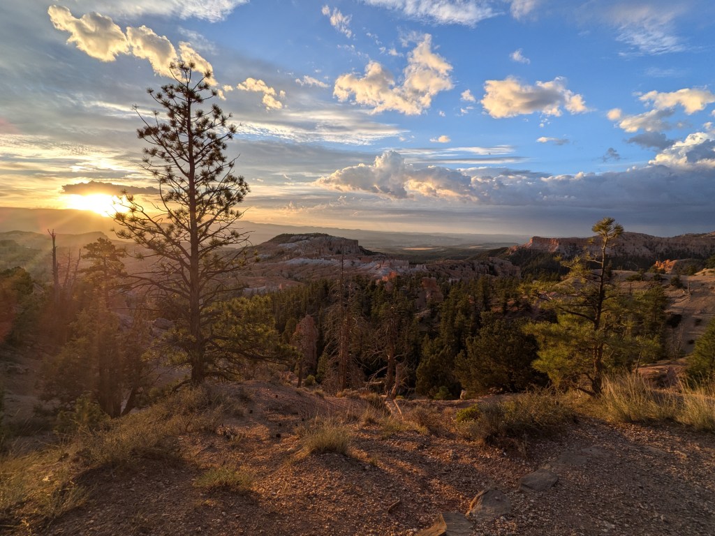
Next day, Sunday, I made the second half of my visit to Bryce Canyon. This time I turned up about 4:30 pm to the bike rental place and got myself two hours on an e-bike.
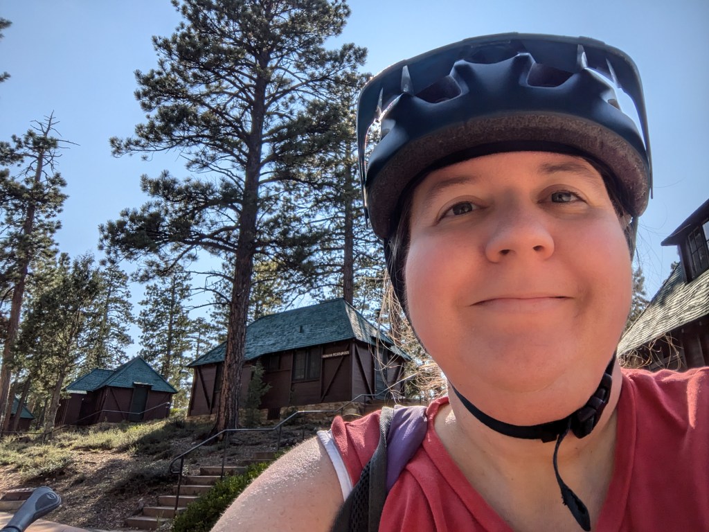
I opted for the e-bike because I knew the trail had some hills and I wanted the power assist on uphill slopes. The attendant had to help me adjust an e-bike to my height. He said the manufacturer claimed they were for adults 5 feet (152cm) and taller, but in his observation they really worked best for people 5’3″ and taller. If I stand up very straight, I’m maybe 5’1″ (155cm). Even with the seat in the lowest position, I was struggling to get on. He helped me out by finding a seat that was bent a little downward to give me another half-inch of clearance, and I managed it. It made stopping a little bit scary, though. With my butt on the seat, I could just barely touch the ground with one toe, so every time I stopped I had to be prepared to lean over to one side before I completely lost momentum, get one foot on the ground, and slide off the seat. Needless to say, I avoided having to stop more than absolutely necessary.
But I had an awesome ride. Like I said before, the multi-use trail winds through pine woods with occasional glimpses of the canyon, and it connects several of the major lookouts.

The weather was perfect, sunny and low 70s F (21C). The e-bike was a pedal assist model with four modes: eco, touring, sport, and turbo. I mostly cruised along in touring or sport mode (which was similar to pedaling a regular bike, with the motor compensating for the e-bike’s greater weight) and got good use out of sport and turbo to go up hills. I still got a workout and was breathing hard by the top of a couple of big slopes, but on a regular bike I probably would have ground to a halt and had to dismount and walk up.


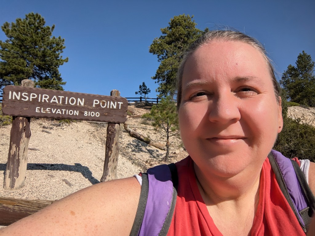
My photos are mostly from the lookouts where I stopped. I didn’t get a lot of pictures of the trail itself because photography and cycling don’t really mix, and like I said, I limited how often I stopped. But it was beautiful and peaceful. I rode down to the south end of the trail at Inspiration Point, went back north to Sunset Point, and then passed up the rental shop and rode a while in the other direction past the Visitors’ Center. The trail actually runs all the way into Bryce Canyon City north of the park, but I had to have the bike back by 7 so I didn’t go that far. I maybe did 3 miles total, and very much enjoyed it. I wish I could enjoy horseback riding like that, but I’m just way more physically and mentally comfortable on a bike.
Once I turned the bike back in, I drove down to Bryce Point, which I hadn’t seen yet. That may have been my favorite of the overlooks. It had a view of these cool formations in white sandstone that looked like someone carved out the beginnings of a temple in the rock. I can see why the local Native Americans had legends about hoodoos as people turned to stone.

Some of the hoodoos in this area had some kind of mineral caps on them, too, that were interesting-looking. A geologist could probably explain what’s going on with that. It almost looked like ice, or salt deposits.

The sun was setting, so I went back to Sunset Point to watch it. Being on the western rim, you can’t watch the sun set over the canyon the way you can watch it rise; the sun actually sets behind the trees on the plateau. But you can watch the shadow of the western rim lengthen across the hoodoos until the last light fades from the distant peaks.

When twilight had fallen, I went into town and got some dinner. Then, when it was really dark, I came back into the park one last time. Like a lot of western parks, Bryce is designated a Dark Skies Park, meaning they have no electric lights so that it’s a good place to stargaze. I haven’t been doing that much so far in the parks because I’m not often there after sunset, but with the skies perfectly clear and the moon rising late, it was too good of a chance to miss. I went back to Sunset Point and found my way to the canyon rim. I had a small flashlight so I wouldn’t get lost or fall over cliffs, but I actually found that the starlight was enough to see by without it.
I didn’t try to take any pictures of the night sky; I don’t think you could see anything from a cell phone picture, and it would have ruined my night vision (and that of the other people who were there doing the same thing). But I could see thousands of stars and the cloud of the Milky Way, which most of us modern city people sadly never see. I’m not much of an astronomer so I can’t give you technical details of exactly which stars or constellations I saw. But in the aggregate, they were gorgeous.
With that, I wrapped up my second half-visit to Bryce and came home. I still want to make it back to Zion again before I move on from this area in a week and a half, plus I have one more park visit to make. Look for more here soon.

Leave a comment